
Station XI DMRK - Debre Markos
Network: XI00 - Ethiopia/Kenya Broadband Seismic Experiment
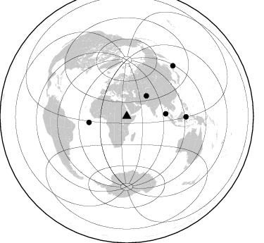
Nearby stations (2 deg radius)

| Station | Name | (Lat, Lon) | Start / End | Elevation |
| DMRK | Debre Markos | (10.31, 37.73) | 2000-03-01 / 2002-12-31 | 2357 m |
| Crust2 Type: | G9,thin custal Archean 0.1 km seds., South American |
| Thickness Estimate: | 40 km |
| Thickness StdDev: | 2.7 km |
| Vp/Vs Estimate: | 1.81 |
| Vp/Vs StdDev: | 0.05 |
| Vs Estimate: | 3.576 km/s |
| Poisson's Ratio: | 0.28 |
| Peak Value: | 0.06 |
| Assumed Vp: | 6.464 km/s |
| Ps Weight: | 0.33333334 |
| PpPs Weight: | 0.33333334 |
| PsPs Weight: | 0.33333328 |
| Residual Complexity: | 0.395 |
| Nearby stations H: | +- |
| (2.0 deg) Vp/Vs: | +- |
1 with match > 90% ( 20.0 %) and 5 with match > 80% ( 100.0 %) out of 5.
Download stack as xyz text file.
Azimuth Distribution of Events:
Prior Results for this Station
| Study | Thickness | Vp/Vs | Vp | Vs | Poissons Ratio | Extra |
| EARS | 40 km | 1.81 | 6.464 km/s | 3.576 km/s | 0.28 | |
| Crust2.0 | 31 km | 1.76 | 6.464 km/s | 3.663 km/s | 0.26 | G9,thin custal Archean 0.1 km seds., South American |
| Global Maxima | 40 km | 1.81 | 6.464 km/s | 3.576 km/s | 0.28 | amp=0.05627647 |
| Local Maxima 1 | 41 km | 1.87 | 6.464 km/s | 3.456 km/s | 0.30 | amp=0.020021578 |
| Local Maxima 2 | 40 km | 1.76 | 6.464 km/s | 3.667 km/s | 0.26 | amp=0.017238725 |
| Local Maxima 3 | 54 km | 1.60 | 6.464 km/s | 4.033 km/s | 0.18 | amp=0.0123058725 |
| Local Maxima 4 | 29 km | 2.09 | 6.464 km/s | 3.1 km/s | 0.35 | amp=0.0107908035 |
| Predicted Arrivals for vertical incidence (zero ray parameter) | |
| Ps | 5.03 SECOND |
| PpPs | 17.48 SECOND |
| PsPs/PpSs | 22.51 SECOND |
Events Processed for this Station
Download zip of receiver functions as SAC
Plot maxima for each earthquake.
Events Used in the Stack
(5 events)| Radial Match | Distance | Baz | FERegion | Time | Lat/Lon | Depth | Magnitude |
| 90.052734 | 40.1 deg | 44.151 deg | Afghanistan-Tajikistan Bord Reg. | 2001/11/23 20:43:03 GMT | (36.4, 71.5) | 106 km | 5.9 MB, 6.1 MW, 6.0 MW |
| 87.90557 | 84.2 deg | 90.598 deg | Minahassa Peninsula, Sulawesi | 2001/03/14 18:56:18 GMT | (0.5, 121.9) | 109 km | 5.9 MB, 6.0 MW, 5.9 MW |
| 86.74754 | 55.5 deg | 86.551 deg | Nicobar Islands, India Region | 2001/03/15 01:22:43 GMT | (8.7, 94.0) | 33 km | 5.6 MB, 5.9 MS, 6.0 MW, 6.0 MW |
| 84.03899 | 54.3 deg | 260.561 deg | North Of Ascension Island | 2001/11/15 01:03:06 GMT | (-1.6, -15.6) | 10 km | 5.5 MB, 6.0 MS, 6.3 MW, 6.3 MW |
| 83.91648 | 97.2 deg | 42.655 deg | Kuril Islands | 2001/05/25 00:40:50 GMT | (44.3, 148.4) | 33 km | 6.1 MB, 6.7 MS, 6.7 MW, 6.6 MW |
Losers
(0 events)| Radial Match | Distance | Baz | FERegion | Time | Lat/Lon | Depth | Magnitude | Reason |
