
Station XJ BPC - Big Pine Canyon
Network: XJ97 - Sierran Paradox
Nearby stations (2 deg radius)

| Station | Name | (Lat, Lon) | Start / End | Elevation |
| BPC | Big Pine Canyon | (37.13, -118.43) | 1997-06-04 / 1997-12-31 | 2370 m |
| Crust2 Type: | M9,thick extended crust, 0.5 km seds. |
| Thickness Estimate: | 39 km |
| Thickness StdDev: | 6.2 km |
| Vp/Vs Estimate: | 1.71 |
| Vp/Vs StdDev: | 0.09 |
| Vs Estimate: | 3.679 km/s |
| Poisson's Ratio: | 0.24 |
| Peak Value: | 0.02 |
| Assumed Vp: | 6.291 km/s |
| Ps Weight: | 0.33333334 |
| PpPs Weight: | 0.33333334 |
| PsPs Weight: | 0.33333328 |
| Residual Complexity: | 0.779 |
| Nearby stations H: | +- |
| (2.0 deg) Vp/Vs: | +- |
3 with match > 90% ( 14.285714 %) and 8 with match > 80% ( 38.095238 %) out of 21.
Download stack as xyz text file.
Azimuth Distribution of Events:

Prior Results for this Station
| Study | Thickness | Vp/Vs | Vp | Vs | Poissons Ratio | Extra |
| EARS | 39 km | 1.71 | 6.291 km/s | 3.679 km/s | 0.24 | |
| Crust2.0 | 40 km | 1.78 | 6.291 km/s | 3.539 km/s | 0.27 | M9,thick extended crust, 0.5 km seds. |
| Global Maxima | 39 km | 1.71 | 6.291 km/s | 3.679 km/s | 0.24 | amp=0.022135513 |
| Local Maxima 1 | 40 km | 1.80 | 6.291 km/s | 3.49 km/s | 0.28 | amp=0.019491863 |
| Local Maxima 2 | 31 km | 1.91 | 6.291 km/s | 3.298 km/s | 0.31 | amp=0.018788086 |
| Local Maxima 3 | 64 km | 1.72 | 6.291 km/s | 3.658 km/s | 0.24 | amp=0.016715854 |
| Local Maxima 4 | 42 km | 1.72 | 6.291 km/s | 3.652 km/s | 0.25 | amp=0.014359914 |
| Predicted Arrivals for vertical incidence (zero ray parameter) | |
| Ps | 4.40 SECOND |
| PpPs | 16.80 SECOND |
| PsPs/PpSs | 21.20 SECOND |
Events Processed for this Station
Download zip of receiver functions as SAC
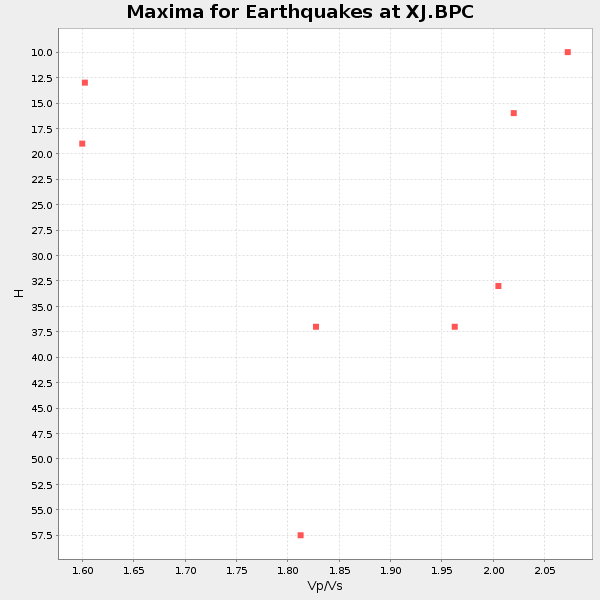
Plot maxima for each earthquake.
Events Used in the Stack
(8 events)| Radial Match | Distance | Baz | FERegion | Time | Lat/Lon | Depth | Magnitude |
| 94.35325 | 80.5 deg | 233.154 deg | South Of Fiji Islands | 1997/10/14 09:53:18 GMT | (-22.1, -176.8) | 167 km | 6.7 MB, 7.7 UNKNOWN, 7.4 ME |
| 92.430786 | 79.8 deg | 140.24 deg | Near Coast Of Central Chile | 1997/07/06 09:54:00 GMT | (-30.1, -71.9) | 19 km | 5.8 MB, 6.5 MS, 6.8 UNKNOWN, 6.4 ME |
| 91.27462 | 85.8 deg | 229.171 deg | Kermadec Islands Region | 1997/09/20 16:11:32 GMT | (-28.7, -177.6) | 30 km | 6.1 MB, 7.0 MS, 7.2 UNKNOWN, 6.7 ME |
| 89.51458 | 44.6 deg | 308.711 deg | Andreanof Islands, Aleutian Is. | 1997/06/17 21:03:40 GMT | (51.3, -179.3) | 33 km | 6.4 MB, 6.3 MS, 6.4 UNKNOWN, 6.6 ML |
| 84.66222 | 73.2 deg | 171.272 deg | Southern East Pacific Rise | 1997/06/10 21:53:55 GMT | (-35.8, -108.1) | 10 km | 5.8 MB, 6.1 MS, 6.5 UNKNOWN, 5.8 MS |
| 83.18462 | 69.1 deg | 308.814 deg | Kuril Islands | 1997/07/14 16:09:35 GMT | (43.2, 146.4) | 33 km | 5.9 MB, 5.8 MS, 6.1 UNKNOWN, 5.8 ME |
| 82.89184 | 51.2 deg | 119.811 deg | Colombia | 1997/09/02 12:13:22 GMT | (3.8, -75.7) | 199 km | 6.5 MB, 6.8 UNKNOWN, 6.4 ME |
| 82.86432 | 77.4 deg | 131.793 deg | Jujuy Province, Argentina | 1997/07/20 10:14:22 GMT | (-23.0, -66.3) | 256 km | 5.7 MB, 6.1 UNKNOWN, 5.7 ME |
Losers
(13 events)| Radial Match | Distance | Baz | FERegion | Time | Lat/Lon | Depth | Magnitude | Reason |
| 79.78253 | 80.1 deg | 140.505 deg | Near Coast Of Central Chile | 1997/07/25 06:47:02 GMT | (-30.5, -71.9) | 33 km | 5.6 MB, 5.5 MS, 6.3 UNKNOWN | |
| 78.80424 | 82.6 deg | 294.142 deg | Volcano Islands, Japan Region | 1997/07/08 02:24:07 GMT | (23.8, 142.7) | 33 km | 5.8 MB, 5.6 MS, 5.9 UNKNOWN, 5.8 MW | |
| 71.13769 | 86.8 deg | 233.21 deg | South Of Fiji Islands | 1997/09/04 04:23:37 GMT | (-26.6, 178.3) | 625 km | 6.3 MB, 6.8 UNKNOWN, 6.5 ME | |
| 64.300224 | 79.3 deg | 139.64 deg | Near Coast Of Central Chile | 1997/07/19 12:22:57 GMT | (-29.3, -71.7) | 26 km | 5.8 MB, 5.5 MS, 5.9 UNKNOWN, 5.8 MW | |
| 60.857933 | 93.6 deg | 305.08 deg | Southwestern Ryukyu Isl., Japan | 1997/08/13 04:45:04 GMT | (25.0, 125.8) | 55 km | 6.0 MB, 5.6 MS, 6.1 UNKNOWN, 6.1 MW | |
| 50.76648 | 88.7 deg | 231.29 deg | Kermadec Islands Region | 1997/10/08 10:47:49 GMT | (-29.2, 178.4) | 617 km | 5.5 MB, 5.7 UNKNOWN | |
| 44.263035 | 97.2 deg | 267.981 deg | Eastern New Guinea Reg., P.N.G. | 1997/06/12 12:07:33 GMT | (-6.0, 147.0) | 33 km | 5.7 MB, 5.9 MS, 6.0 UNKNOWN | |
| 37.693325 | 85.6 deg | 240.088 deg | Vanuatu Islands Region | 1997/06/24 16:17:09 GMT | (-20.7, 174.2) | 33 km | 5.5 MS, 5.2 MB, 5.9 UNKNOWN, 5.9 MW | |
| 37.094982 | 91.3 deg | 263.49 deg | Solomon Islands | 1997/09/07 12:57:06 GMT | (-6.0, 154.5) | 421 km | 5.6 MB, 5.8 UNKNOWN, 5.8 MW | |
| 36.731773 | 96.0 deg | 306.98 deg | Taiwan Region | 1997/07/15 11:05:31 GMT | (24.7, 122.4) | 103 km | 5.6 MB, 5.6 UNKNOWN, 5.6 MW | |
| 34.292698 | 92.4 deg | 186.037 deg | Pacific-Antarctic Ridge | 1997/09/03 06:22:44 GMT | (-55.2, -129.0) | 10 km | 5.1 MB, 6.0 MS, 6.1 UNKNOWN, 6.0 MW | |
| 33.943027 | 78.9 deg | 237.596 deg | Fiji Islands Region | 1997/06/11 11:53:32 GMT | (-17.8, -178.8) | 573 km | 5.5 UNKNOWN, 4.9 MB | |
| 33.104237 | 80.3 deg | 234.749 deg | Fiji Islands Region | 1997/08/25 11:59:00 GMT | (-20.8, -177.8) | 394 km | 5.5 UNKNOWN, 5.3 MB |
