
Station XK N21 - North 21
Network: XK99 - CDROM (Colorado)
Nearby stations (2 deg radius)

| Station | Name | (Lat, Lon) | Start / End | Elevation |
| N21 | North 21 | (40.45, -106.92) | 1999-06-11 / 2000-12-31 | 2064 m |
| Crust2 Type: | P1,orogen/46km, Urals, Tethian Orogen, 2 km seds. |
| Thickness Estimate: | 45 km |
| Thickness StdDev: | 1.7 km |
| Vp/Vs Estimate: | 1.84 |
| Vp/Vs StdDev: | 0.03 |
| Vs Estimate: | 3.352 km/s |
| Poisson's Ratio: | 0.29 |
| Peak Value: | 0.03 |
| Assumed Vp: | 6.159 km/s |
| Ps Weight: | 0.33333334 |
| PpPs Weight: | 0.33333334 |
| PsPs Weight: | 0.33333328 |
| Residual Complexity: | 0.566 |
| Nearby stations H: | +- |
| (2.0 deg) Vp/Vs: | +- |
5 with match > 90% ( 31.25 %) and 16 with match > 80% ( 100.0 %) out of 16.
Download stack as xyz text file.
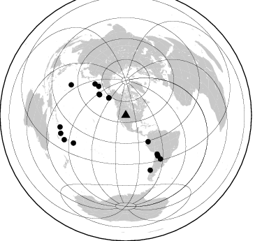
Azimuth Distribution of Events:
Prior Results for this Station
| Study | Thickness | Vp/Vs | Vp | Vs | Poissons Ratio | Extra |
| EARS | 45 km | 1.84 | 6.159 km/s | 3.352 km/s | 0.29 | |
| Crust2.0 | 46 km | 1.76 | 6.159 km/s | 3.507 km/s | 0.26 | P1,orogen/46km, Urals, Tethian Orogen, 2 km seds. |
| Global Maxima | 45 km | 1.84 | 6.159 km/s | 3.352 km/s | 0.29 | amp=0.02798642 |
| Local Maxima 1 | 50 km | 1.82 | 6.159 km/s | 3.384 km/s | 0.28 | amp=0.013711281 |
| Local Maxima 2 | 34 km | 2.10 | 6.159 km/s | 2.94 km/s | 0.35 | amp=0.011767872 |
| Local Maxima 3 | 42 km | 1.96 | 6.159 km/s | 3.146 km/s | 0.32 | amp=0.010138242 |
| Local Maxima 4 | 60 km | 1.64 | 6.159 km/s | 3.761 km/s | 0.20 | amp=0.007955914 |
| Predicted Arrivals for vertical incidence (zero ray parameter) | |
| Ps | 6.09 SECOND |
| PpPs | 20.62 SECOND |
| PsPs/PpSs | 26.70 SECOND |
Events Processed for this Station
Download zip of receiver functions as SAC
Plot maxima for each earthquake.
Events Used in the Stack
(16 events)| Radial Match | Distance | Baz | FERegion | Time | Lat/Lon | Depth | Magnitude |
| 97.678154 | 89.4 deg | 299.123 deg | Volcano Islands, Japan Region | 2000/03/28 11:00:22 GMT | (22.3, 143.7) | 126 km | 6.8 MB, 7.6 MS, 7.6 MW, 7.6 MW |
| 96.80846 | 74.0 deg | 141.71 deg | Jujuy Province, Argentina | 2000/05/12 18:43:18 GMT | (-23.5, -66.5) | 225 km | 6.2 MB, 7.2 MW, 7.1 MW |
| 94.0828 | 34.7 deg | 315.448 deg | Kodiak Island Region, Alaska | 1999/12/06 23:12:33 GMT | (57.4, -154.5) | 66 km | 6.8 MB, 7.0 MW, 7.0 ML |
| 92.837944 | 85.7 deg | 155.985 deg | Off Coast Of Southern Chile | 1999/08/22 09:35:39 GMT | (-40.5, -74.8) | 33 km | 6.2 MB, 5.8 MS, 6.4 MW, 6.2 MW |
| 90.04649 | 79.6 deg | 141.551 deg | Santiago Del Estero Prov., Arg. | 2000/04/23 09:27:23 GMT | (-28.3, -63.0) | 608 km | 6.6 MB, 7.0 MW, 7.0 MW |
| 89.936424 | 56.9 deg | 316.749 deg | Komandorskiye Ostrova Region | 1999/11/26 00:29:00 GMT | (55.1, 165.4) | 33 km | 5.6 MB, 5.8 MS |
| 89.08248 | 94.6 deg | 248.39 deg | Vanuatu Islands Region | 2000/02/25 01:43:58 GMT | (-19.5, 173.8) | 33 km | 6.1 MB, 7.1 MS, 7.1 MW, 7.0 MW |
| 88.59267 | 49.4 deg | 139.798 deg | Ecuador | 1999/08/28 12:40:06 GMT | (-1.3, -77.5) | 196 km | 5.9 MB, 6.3 MW, 6.2 MW |
| 88.464 | 47.7 deg | 307.795 deg | Andreanof Islands, Aleutian Is. | 1999/08/01 12:47:50 GMT | (51.5, -176.3) | 33 km | 5.5 MB, 5.5 MS, 5.8 MW, 5.8 MW |
| 87.86313 | 34.7 deg | 315.356 deg | Kodiak Island Region, Alaska | 1999/12/07 00:19:49 GMT | (57.4, -154.5) | 41 km | 6.5 MB, 6.1 MS, 6.4 MW, 6.3 ML |
| 86.960686 | 48.9 deg | 308.094 deg | Andreanof Islands, Aleutian Is. | 2000/04/21 04:35:17 GMT | (51.4, -178.1) | 33 km | 6.0 MB, 5.7 MS, 6.2 ML, 6.0 MW |
| 86.45866 | 95.5 deg | 259.906 deg | Santa Cruz Islands | 2000/05/06 13:44:13 GMT | (-11.3, 165.4) | 12 km | 6.0 MB, 6.3 MS, 6.3 MW, 5.8 ME |
| 86.32189 | 84.7 deg | 242.118 deg | Tonga Islands | 2000/01/26 13:26:50 GMT | (-17.3, -174.0) | 33 km | 5.9 MB, 6.0 MS, 6.4 MW, 6.3 MW |
| 84.689575 | 71.4 deg | 140.993 deg | Southern Bolivia | 1999/09/15 03:01:24 GMT | (-20.9, -67.3) | 218 km | 6.0 MB, 6.4 MW, 6.4 MW |
| 84.15262 | 62.9 deg | 315.283 deg | Near East Coast Of Kamchatka | 1999/09/18 21:28:33 GMT | (51.2, 157.6) | 60 km | 5.9 MB, 5.6 MS, 6.2 MW, 6.0 MW |
| 83.664566 | 96.6 deg | 254.577 deg | Vanuatu Islands | 1999/08/22 12:40:45 GMT | (-16.1, 168.0) | 33 km | 6.3 MB, 6.2 MS, 6.5 MW, 6.5 MW |
Losers
(0 events)| Radial Match | Distance | Baz | FERegion | Time | Lat/Lon | Depth | Magnitude | Reason |
