
Station XK S16 - South 16
Network: XK99 - CDROM (Colorado)
Nearby stations (2 deg radius)

| Station | Name | (Lat, Lon) | Start / End | Elevation |
| S16 | South 16 | (35.87, -105.20) | 1999-04-18 / 2000-12-31 | 2099 m |
| Crust2 Type: | Q2,orogen/39km no ice, Appalachians, North Andes, 0.5 km seds. |
| Thickness Estimate: | 55 km |
| Thickness StdDev: | 3.3 km |
| Vp/Vs Estimate: | 1.65 |
| Vp/Vs StdDev: | 0.05 |
| Vs Estimate: | 3.885 km/s |
| Poisson's Ratio: | 0.21 |
| Peak Value: | 0.02 |
| Assumed Vp: | 6.419 km/s |
| Ps Weight: | 0.33333334 |
| PpPs Weight: | 0.33333334 |
| PsPs Weight: | 0.33333328 |
| Residual Complexity: | 0.420 |
| Nearby stations H: | +- |
| (2.0 deg) Vp/Vs: | +- |
2 with match > 90% ( 40.0 %) and 5 with match > 80% ( 100.0 %) out of 5.
Download stack as xyz text file.
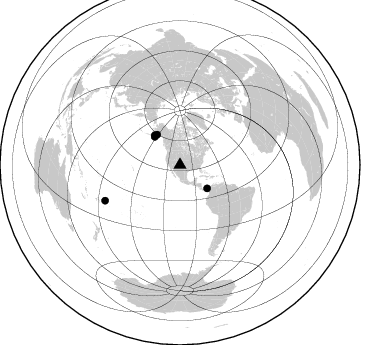
Azimuth Distribution of Events:
Prior Results for this Station
| Study | Thickness | Vp/Vs | Vp | Vs | Poissons Ratio | Extra |
| EARS | 55 km | 1.65 | 6.419 km/s | 3.885 km/s | 0.21 | |
| Crust2.0 | 39 km | 1.75 | 6.419 km/s | 3.659 km/s | 0.26 | Q2,orogen/39km no ice, Appalachians, North Andes, 0.5 km seds. |
| Global Maxima | 55 km | 1.65 | 6.419 km/s | 3.885 km/s | 0.21 | amp=0.022892464 |
| Local Maxima 1 | 42 km | 1.86 | 6.419 km/s | 3.451 km/s | 0.30 | amp=0.008518745 |
| Local Maxima 2 | 62 km | 1.77 | 6.419 km/s | 3.632 km/s | 0.26 | amp=0.007315068 |
| Local Maxima 3 | 53 km | 1.68 | 6.419 km/s | 3.832 km/s | 0.22 | amp=0.00382837 |
| Local Maxima 4 | 70 km | 1.74 | 6.419 km/s | 3.695 km/s | 0.25 | amp=0.002297419 |
| Predicted Arrivals for vertical incidence (zero ray parameter) | |
| Ps | 5.57 SECOND |
| PpPs | 22.62 SECOND |
| PsPs/PpSs | 28.19 SECOND |
Events Processed for this Station
Download zip of receiver functions as SAC
Plot maxima for each earthquake.
Events Used in the Stack
(5 events)| Radial Match | Distance | Baz | FERegion | Time | Lat/Lon | Depth | Magnitude |
| 94.99003 | 39.0 deg | 319.309 deg | Kodiak Island Region, Alaska | 1999/12/06 23:12:33 GMT | (57.4, -154.5) | 66 km | 6.8 MB, 7.0 MW, 7.0 ML |
| 93.46611 | 37.9 deg | 318.023 deg | Kodiak Island Region, Alaska | 1999/05/07 14:13:52 GMT | (56.4, -152.9) | 20 km | 5.7 MB, 6.1 MS, 6.4 MW, 5.7 ME |
| 85.888336 | 82.9 deg | 244.675 deg | Tonga Islands | 1999/12/07 21:29:49 GMT | (-15.9, -174.0) | 138 km | 6.2 MB, 6.4 MW, 6.4 MW |
| 81.15822 | 35.8 deg | 130.818 deg | Panama | 2000/02/26 18:24:39 GMT | (9.4, -78.5) | 65 km | 5.8 MB, 5.4 MS, 6.2 MW, 6.1 MW |
| 80.89896 | 37.9 deg | 322.871 deg | Kenai Peninsula, Alaska | 1999/05/05 10:30:03 GMT | (59.3, -151.5) | 71 km | 5.4 MB, 5.8 MW, 5.8 MW |
Losers
(0 events)| Radial Match | Distance | Baz | FERegion | Time | Lat/Lon | Depth | Magnitude | Reason |
