
Station XL S115 - Milepost 40
Network: XL97 - Deep Probe (Archean-Proterozoic)
Nearby stations (2 deg radius)
| Station | Name | (Lat, Lon) | Start / End | Elevation |
| S115 | Milepost 40 | (41.20, -108.83) | 1997-05-13 / 1997-12-31 | 2188 m |
| Crust2 Type: | Q4,orogen/43km no ice, Tethian Belt, 5 km seds. |
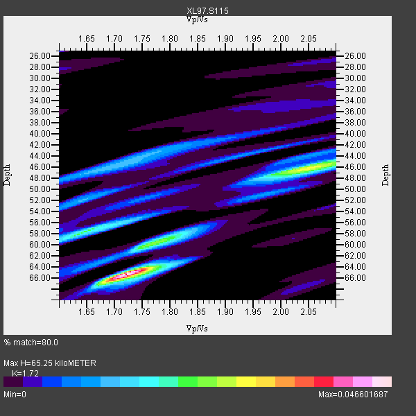
| Thickness Estimate: | 65 km |
| Thickness StdDev: | 8.9 km |
| Vp/Vs Estimate: | 1.72 |
| Vp/Vs StdDev: | 0.14 |
| Vs Estimate: | 3.609 km/s |
| Poisson's Ratio: | 0.24 |
| Peak Value: | 0.05 |
| Assumed Vp: | 6.207 km/s |
| Ps Weight: | 0.33333334 |
| PpPs Weight: | 0.33333334 |
| PsPs Weight: | 0.33333328 |
| Residual Complexity: | 0.720 |
| Nearby stations H: | +- |
| (2.0 deg) Vp/Vs: | +- |
1 with match > 90% ( 16.666666 %) and 3 with match > 80% ( 50.0 %) out of 6.
Download stack as xyz text file.
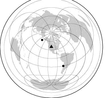
Azimuth Distribution of Events:
Prior Results for this Station
| Study | Thickness | Vp/Vs | Vp | Vs | Poissons Ratio | Extra |
| EARS | 65 km | 1.72 | 6.207 km/s | 3.609 km/s | 0.24 | |
| Crust2.0 | 43 km | 1.76 | 6.207 km/s | 3.535 km/s | 0.26 | Q4,orogen/43km no ice, Tethian Belt, 5 km seds. |
| Global Maxima | 65 km | 1.72 | 6.207 km/s | 3.609 km/s | 0.24 | amp=0.046601687 |
| Local Maxima 1 | 46 km | 2.06 | 6.207 km/s | 3.02 km/s | 0.34 | amp=0.027707081 |
| Local Maxima 2 | 58 km | 1.65 | 6.207 km/s | 3.768 km/s | 0.21 | amp=0.022289043 |
| Local Maxima 3 | 60 km | 1.76 | 6.207 km/s | 3.532 km/s | 0.26 | amp=0.016839841 |
| Local Maxima 4 | 46 km | 1.70 | 6.207 km/s | 3.646 km/s | 0.24 | amp=0.013671885 |
| Predicted Arrivals for vertical incidence (zero ray parameter) | |
| Ps | 7.57 SECOND |
| PpPs | 28.59 SECOND |
| PsPs/PpSs | 36.16 SECOND |
Events Processed for this Station
Download zip of receiver functions as SAC
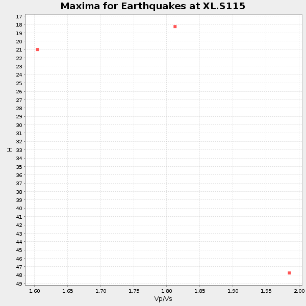
Plot maxima for each earthquake.
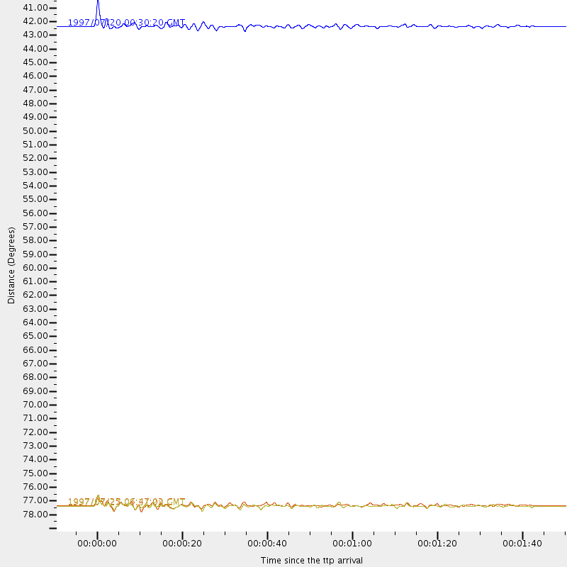
Events Used in the Stack
(3 events)| Radial Match | Distance | Baz | FERegion | Time | Lat/Lon | Depth | Magnitude |
| 90.812256 | 79.1 deg | 148.098 deg | Near Coast Of Central Chile | 1997/07/27 05:21:29 GMT | (-30.5, -71.9) | 33 km | 5.6 MB, 5.8 MS, 6.3 UNKNOWN, 6.2 MW |
| 88.77662 | 40.6 deg | 306.747 deg | Fox Islands, Aleutian Islands | 1997/07/20 00:30:20 GMT | (52.6, -167.5) | 14 km | 5.6 MB, 5.9 MS, 6.2 UNKNOWN, 6.2 MW |
| 85.553604 | 79.1 deg | 148.106 deg | Near Coast Of Central Chile | 1997/07/25 06:47:02 GMT | (-30.5, -71.9) | 33 km | 5.6 MB, 5.5 MS, 6.3 UNKNOWN |
Losers
(3 events)| Radial Match | Distance | Baz | FERegion | Time | Lat/Lon | Depth | Magnitude | Reason |
| 78.440735 | 78.1 deg | 147.375 deg | Near Coast Of Central Chile | 1997/07/19 12:22:57 GMT | (-29.3, -71.7) | 26 km | 5.8 MB, 5.5 MS, 5.9 UNKNOWN, 5.8 MW | |
| 67.87588 | 75.1 deg | 139.854 deg | Jujuy Province, Argentina | 1997/07/20 10:14:22 GMT | (-23.0, -66.3) | 256 km | 5.7 MB, 6.1 UNKNOWN, 5.7 ME | |
| 63.889786 | 90.8 deg | 38.715 deg | Central Mediterranean Sea | 1997/07/27 10:07:52 GMT | (35.6, 21.1) | 33 km | 5.5 MB, 4.8 MS, 5.6 UNKNOWN, 5.2 ML |
