
Station XL S235 - Plateau Creek
Network: XL97 - Deep Probe (Archean-Proterozoic)
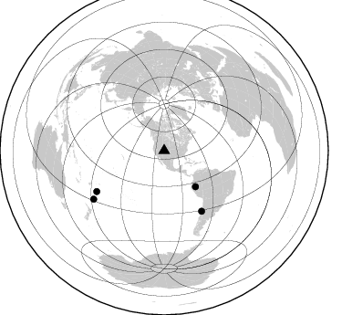
Nearby stations (2 deg radius)
| Station | Name | (Lat, Lon) | Start / End | Elevation |
| S235 | Plateau Creek | (39.27, -108.04) | 1997-08-13 / 1997-12-31 | 1948 m |
| Crust2 Type: | Q3,orogen/43km no ice, Appalachians, 3 km seds. |
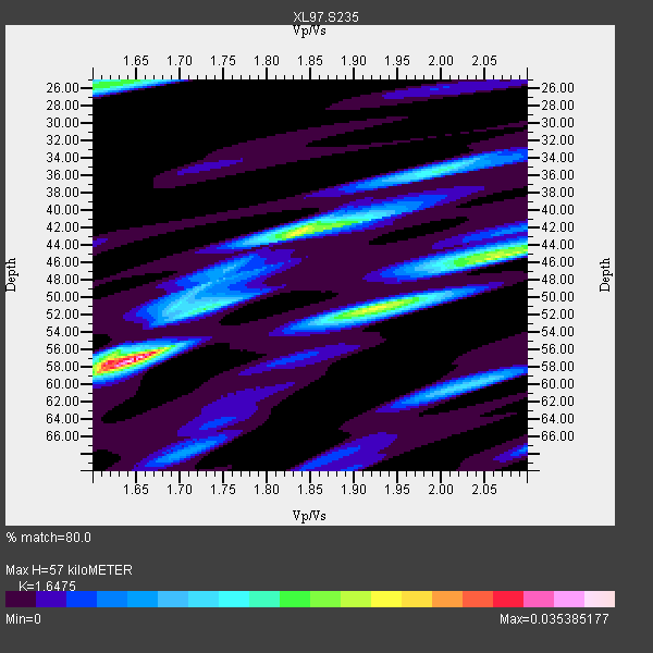
| Thickness Estimate: | 57 km |
| Thickness StdDev: | 6.0 km |
| Vp/Vs Estimate: | 1.65 |
| Vp/Vs StdDev: | 0.17 |
| Vs Estimate: | 3.818 km/s |
| Poisson's Ratio: | 0.21 |
| Peak Value: | 0.04 |
| Assumed Vp: | 6.291 km/s |
| Ps Weight: | 0.33333334 |
| PpPs Weight: | 0.33333334 |
| PsPs Weight: | 0.33333328 |
| Residual Complexity: | 0.718 |
| Nearby stations H: | +- |
| (2.0 deg) Vp/Vs: | +- |
2 with match > 90% ( 22.222221 %) and 4 with match > 80% ( 44.444443 %) out of 9.
Download stack as xyz text file.
Azimuth Distribution of Events:
Prior Results for this Station
| Study | Thickness | Vp/Vs | Vp | Vs | Poissons Ratio | Extra |
| EARS | 57 km | 1.65 | 6.291 km/s | 3.818 km/s | 0.21 | |
| Crust2.0 | 43 km | 1.76 | 6.291 km/s | 3.577 km/s | 0.26 | Q3,orogen/43km no ice, Appalachians, 3 km seds. |
| Global Maxima | 57 km | 1.65 | 6.291 km/s | 3.818 km/s | 0.21 | amp=0.035385177 |
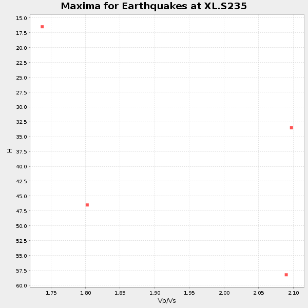
| Local Maxima 1 | 42 km | 1.84 | 6.291 km/s | 3.424 km/s | 0.29 | amp=0.02240596 |
| Local Maxima 2 | 45 km | 2.07 | 6.291 km/s | 3.046 km/s | 0.35 | amp=0.020848539 |
| Local Maxima 3 | 26 km | 1.62 | 6.291 km/s | 3.895 km/s | 0.19 | amp=0.017474234 |
| Local Maxima 4 | 51 km | 1.92 | 6.291 km/s | 3.268 km/s | 0.32 | amp=0.014841712 |
| Predicted Arrivals for vertical incidence (zero ray parameter) | |
| Ps | 5.87 SECOND |
| PpPs | 23.99 SECOND |
| PsPs/PpSs | 29.86 SECOND |
Events Processed for this Station
Download zip of receiver functions as SAC
Plot maxima for each earthquake.
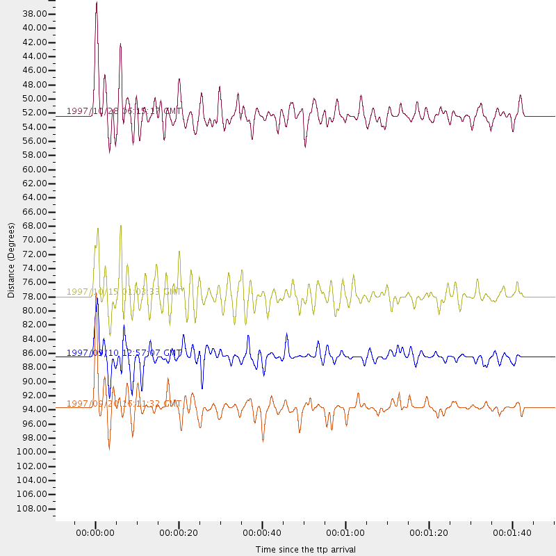
Events Used in the Stack
(4 events)| Radial Match | Distance | Baz | FERegion | Time | Lat/Lon | Depth | Magnitude |
| 91.78229 | 77.8 deg | 148.203 deg | Near Coast Of Central Chile | 1997/10/15 01:03:33 GMT | (-30.9, -71.2) | 58 km | 6.8 MB, 6.8 MS, 7.3 UNKNOWN, 7.1 MW |
| 90.841705 | 52.2 deg | 138.93 deg | Northern Peru | 1997/10/28 06:15:17 GMT | (-4.4, -76.7) | 112 km | 6.6 MB, 6.3 MS, 7.2 UNKNOWN, 6.6 ME |
| 85.02682 | 93.6 deg | 235.597 deg | Kermadec Islands Region | 1997/09/20 16:11:32 GMT | (-28.7, -177.6) | 30 km | 6.1 MB, 7.0 MS, 7.2 UNKNOWN, 6.7 ME |
| 80.66586 | 86.4 deg | 238.819 deg | Tonga Islands | 1997/09/10 12:57:07 GMT | (-21.3, -174.4) | 10 km | 5.7 MB, 6.1 MS, 6.1 UNKNOWN, 5.9 MW |
Losers
(5 events)| Radial Match | Distance | Baz | FERegion | Time | Lat/Lon | Depth | Magnitude | Reason |
| 74.87358 | 94.8 deg | 239.58 deg | South Of Fiji Islands | 1997/09/04 04:23:37 GMT | (-26.6, 178.3) | 625 km | 6.3 MB, 6.8 UNKNOWN, 6.5 ME | |
| 65.76648 | 94.4 deg | 256.773 deg | Vanuatu Islands | 1997/10/31 12:29:49 GMT | (-13.1, 166.9) | 183 km | 5.9 UNKNOWN, 5.4 MB | |
| 53.25876 | 87.2 deg | 238.912 deg | Tonga Islands | 1997/10/19 15:53:38 GMT | (-21.8, -175.0) | 33 km | 5.6 MB, 5.9 MS | |
| 48.53277 | 89.5 deg | 242.154 deg | Fiji Islands Region | 1997/11/04 10:40:43 GMT | (-21.0, -179.2) | 621 km | 5.7 UNKNOWN, 5.1 MB | |
| 46.93604 | 88.3 deg | 241.411 deg | Fiji Islands Region | 1997/08/25 11:59:00 GMT | (-20.8, -177.8) | 394 km | 5.5 UNKNOWN, 5.3 MB |
