
Station XN 061 - Saugus, CA #20
Network: XN98 - LARSE II - Passive Phase
Nearby stations (2 deg radius)

| Station | Name | (Lat, Lon) | Start / End | Elevation |
| 061 | Saugus, CA #20 | (34.58, -118.46) | 1998-10-26 / 1999-12-31 | 0.6 km |
| Crust2 Type: | M1,extended crust, 3 km seds. |
| Thickness Estimate: | 55 km |
| Thickness StdDev: | 9.6 km |
| Vp/Vs Estimate: | 1.84 |
| Vp/Vs StdDev: | 0.12 |
| Vs Estimate: | 3.32 km/s |
| Poisson's Ratio: | 0.29 |
| Peak Value: | 0.03 |
| Assumed Vp: | 6.1 km/s |
| Ps Weight: | 0.33333334 |
| PpPs Weight: | 0.33333334 |
| PsPs Weight: | 0.33333328 |
| Residual Complexity: | 0.871 |
| Nearby stations H: | +- |
| (2.0 deg) Vp/Vs: | +- |
0 with match > 90% ( 0.0 %) and 3 with match > 80% ( 100.0 %) out of 3.
Download stack as xyz text file.
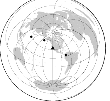
Azimuth Distribution of Events:
Prior Results for this Station
| Study | Thickness | Vp/Vs | Vp | Vs | Poissons Ratio | Extra |
| EARS | 55 km | 1.84 | 6.1 km/s | 3.32 km/s | 0.29 | |
| Crust2.0 | 31 km | 1.78 | 6.1 km/s | 3.426 km/s | 0.27 | M1,extended crust, 3 km seds. |
| Global Maxima | 55 km | 1.84 | 6.1 km/s | 3.32 km/s | 0.29 | amp=0.032593887 |
| Local Maxima 1 | 45 km | 1.60 | 6.1 km/s | 3.812 km/s | 0.18 | amp=0.029218214 |
| Local Maxima 2 | 25 km | 1.91 | 6.1 km/s | 3.19 km/s | 0.31 | amp=0.022298444 |
| Local Maxima 3 | 41 km | 1.73 | 6.1 km/s | 3.536 km/s | 0.25 | amp=0.019999897 |
| Local Maxima 4 | 42 km | 2.08 | 6.1 km/s | 2.933 km/s | 0.35 | amp=0.016684402 |
| Predicted Arrivals for vertical incidence (zero ray parameter) | |
| Ps | 7.55 SECOND |
| PpPs | 25.58 SECOND |
| PsPs/PpSs | 33.14 SECOND |
Events Processed for this Station
Download zip of receiver functions as SAC
Plot maxima for each earthquake.
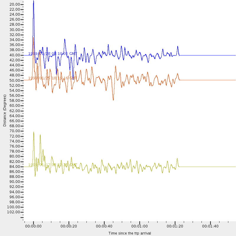
Events Used in the Stack
(3 events)| Radial Match | Distance | Baz | FERegion | Time | Lat/Lon | Depth | Magnitude |
| 89.44926 | 40.0 deg | 313.15 deg | Fox Islands, Aleutian Islands | 1999/01/28 08:10:05 GMT | (52.9, -169.1) | 67 km | 6.3 MB, 6.1 MS, 6.6 MW, 6.6 ME |
| 88.59129 | 83.8 deg | 298.139 deg | Bonin Islands, Japan Region | 1999/01/12 02:32:25 GMT | (26.7, 140.2) | 441 km | 5.9 MB, 6.1 MW, 5.9 MW |
| 83.46327 | 49.6 deg | 117.35 deg | Colombia | 1999/01/25 18:19:16 GMT | (4.5, -75.7) | 17 km | 5.9 MB, 5.7 MS, 6.3 ME, 6.2 MW |
Losers
(0 events)| Radial Match | Distance | Baz | FERegion | Time | Lat/Lon | Depth | Magnitude | Reason |
