
Station XO KS13 - Akhiok School, AK
Network: XO18 - AACE: Alaska Amphibious Community seismic Experimen
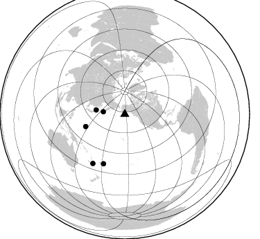
Nearby stations (2 deg radius)

| Station | Name | (Lat, Lon) | Start / End | Elevation |
| KS13 | Akhiok School, AK | (56.95, -154.17) | 2018-05-22 / 2019-12-31 | 46 m |
| Crust2 Type: | C2,continental shelf, 1 km seds. |
| Thickness Estimate: | 35 km |
| Thickness StdDev: | 2.2 km |
| Vp/Vs Estimate: | 1.80 |
| Vp/Vs StdDev: | 0.09 |
| Vs Estimate: | 3.467 km/s |
| Poisson's Ratio: | 0.28 |
| Peak Value: | 0.09 |
| Assumed Vp: | 6.24 km/s |
| Ps Weight: | 0.33333334 |
| PpPs Weight: | 0.33333334 |
| PsPs Weight: | 0.33333328 |
| Residual Complexity: | 0.686 |
| Nearby stations H: | +- |
| (2.0 deg) Vp/Vs: | +- |
2 with match > 90% ( 4.0816326 %) and 5 with match > 80% ( 10.204082 %) out of 49.
Download stack as xyz text file.
Azimuth Distribution of Events:
Prior Results for this Station
| Study | Thickness | Vp/Vs | Vp | Vs | Poissons Ratio | Extra |
| EARS | 35 km | 1.80 | 6.24 km/s | 3.467 km/s | 0.28 | |
| Crust2.0 | 30 km | 1.80 | 6.24 km/s | 3.467 km/s | 0.28 | C2,continental shelf, 1 km seds. |
| Global Maxima | 35 km | 1.80 | 6.24 km/s | 3.467 km/s | 0.28 | amp=0.09205006 |
| Local Maxima 1 | 32 km | 1.76 | 6.24 km/s | 3.535 km/s | 0.26 | amp=0.07885973 |
| Local Maxima 2 | 30 km | 2.09 | 6.24 km/s | 2.986 km/s | 0.35 | amp=0.06999887 |
| Local Maxima 3 | 32 km | 1.88 | 6.24 km/s | 3.315 km/s | 0.30 | amp=0.04686065 |
| Local Maxima 4 | 38 km | 1.70 | 6.24 km/s | 3.681 km/s | 0.23 | amp=0.039487313 |
| Predicted Arrivals for vertical incidence (zero ray parameter) | |
| Ps | 4.49 SECOND |
| PpPs | 15.71 SECOND |
| PsPs/PpSs | 20.19 SECOND |
Events Processed for this Station
Download zip of receiver functions as SAC
Plot maxima for each earthquake.
Events Used in the Stack
(5 events)| Radial Match | Distance | Baz | FERegion | Time | Lat/Lon | Depth | Magnitude |
| 93.28036 | 59.2 deg | 252.475 deg | Mariana Islands Region | 2018/08/28 22:35:14 GMT | (16.8, 147.1) | 53 km | 6.6 Mi |
| 91.99662 | 77.5 deg | 203.275 deg | Fiji Islands Region | 2018/08/19 00:19:37 GMT | (-18.2, -178.1) | 563 km | 8.2 mww |
| 84.44332 | 42.0 deg | 278.509 deg | Hokkaido, Japan Region | 2018/09/05 18:07:58 GMT | (42.7, 141.9) | 31 km | 6.6 Mww |
| 82.596405 | 84.4 deg | 213.053 deg | Southeast Of Loyalty Islands | 2018/08/29 03:51:55 GMT | (-22.2, 170.0) | 10 km | 7.0 Mi |
| 80.90717 | 31.4 deg | 276.513 deg | Kuril Islands | 2018/08/10 18:12:05 GMT | (48.5, 154.8) | 16 km | 5.9 Mww |
Losers
(44 events)| Radial Match | Distance | Baz | FERegion | Time | Lat/Lon | Depth | Magnitude | Reason |
| 94.70782 | 78.2 deg | 205.476 deg | Fiji Islands | 2018/09/06 15:49:17 GMT | (-18.4, 179.5) | 669 km | 8.1 Mi | |
| 76.98311 | 79.2 deg | 216.754 deg | Vanuatu Islands | 2018/08/21 22:32:27 GMT | (-16.0, 168.2) | 13 km | 6.5 Mww | |
| 75.43011 | 48.1 deg | 271.969 deg | Near East Coast Of Honshu, Japan | 2018/07/07 11:23:49 GMT | (35.1, 140.7) | 39 km | 5.9 Mww | |
| 73.10865 | 52.3 deg | 115.485 deg | Near Coast Of Jalisco, Mexico | 2018/06/30 03:56:50 GMT | (19.1, -105.1) | 15 km | 5.9 Mww | |
| 70.72062 | 96.8 deg | 265.168 deg | Sumbawa Region, Indonesia | 2018/08/05 12:49:55 GMT | (-8.4, 116.1) | 31 km | 5.5 mb | |
| 69.34547 | 77.8 deg | 198.814 deg | Tonga Islands | 2018/06/03 00:48:09 GMT | (-19.4, -173.7) | 10 km | 5.6 mb | |
| 67.79028 | 80.0 deg | 265.33 deg | Mindanao, Philippines | 2018/07/03 09:59:54 GMT | (5.9, 125.2) | 100 km | 5.6 Mww | |
| 65.81618 | 80.9 deg | 216.253 deg | Vanuatu Islands | 2018/06/21 21:13:32 GMT | (-17.8, 168.0) | 22 km | 6.1 Mww | |
| 62.36072 | 81.6 deg | 214.972 deg | Vanuatu Islands | 2018/07/13 09:46:49 GMT | (-18.9, 169.0) | 169 km | 6.4 Mww | |
| 61.877773 | 57.1 deg | 109.083 deg | Oaxaca, Mexico | 2018/07/19 13:31:53 GMT | (17.8, -97.8) | 55 km | 5.7 Mww | |
| 59.365025 | 95.6 deg | 101.551 deg | Peru-Brazil Border Region | 2018/08/24 09:04:06 GMT | (-11.0, -70.8) | 609 km | 7.1 Mww | |
| 59.2777 | 75.8 deg | 219.995 deg | Santa Cruz Islands | 2018/07/17 07:02:55 GMT | (-11.7, 166.3) | 60 km | 5.9 Mww | |
| 58.8849 | 76.3 deg | 203.48 deg | Fiji Islands Region | 2018/08/19 04:28:58 GMT | (-17.0, -178.0) | 416 km | 6.8 mww | |
| 56.94115 | 72.4 deg | 101.25 deg | Costa Rica | 2018/08/17 23:22:24 GMT | (8.8, -83.2) | 15 km | 6.1 Mww | |
| 56.618294 | 75.3 deg | 238.354 deg | New Ireland Region, P.N.G. | 2018/09/03 07:15:30 GMT | (-3.8, 150.2) | 10 km | 5.5 Mww | |
| 56.275284 | 77.3 deg | 203.152 deg | Fiji Islands Region | 2018/08/28 13:09:10 GMT | (-18.0, -177.9) | 592 km | 5.7 Mww | |
| 55.03324 | 84.0 deg | 214.66 deg | Loyalty Islands | 2018/07/08 01:08:28 GMT | (-21.3, 168.5) | 10 km | 5.5 Mww | |
| 54.682053 | 88.8 deg | 200.046 deg | Kermadec Islands, New Zealand | 2018/07/28 09:28:20 GMT | (-30.0, -177.4) | 35 km | 5.6 Mww | |
| 54.155006 | 89.5 deg | 200.402 deg | Kermadec Islands, New Zealand | 2018/07/07 21:33:49 GMT | (-30.6, -178.0) | 34 km | 5.9 Mww | |
| 53.465332 | 96.5 deg | 264.823 deg | Sumbawa Region, Indonesia | 2018/08/19 04:10:21 GMT | (-8.3, 116.6) | 7.9 km | 6.3 Mww | |
| 50.371063 | 78.0 deg | 238.589 deg | New Britain Region, P.N.G. | 2018/07/19 18:30:32 GMT | (-6.1, 148.7) | 30 km | 6.0 Mww | |
| 49.80509 | 94.0 deg | 262.628 deg | Flores Sea | 2018/08/17 15:35:02 GMT | (-7.4, 119.8) | 539 km | 6.5 Mww | |
| 47.54356 | 77.3 deg | 203.414 deg | Fiji Islands Region | 2018/08/19 00:32:59 GMT | (-17.9, -178.2) | 520 km | 5.7 mb | |
| 47.284714 | 76.0 deg | 273.289 deg | Mindoro, Philippines | 2018/08/31 14:40:29 GMT | (13.6, 120.9) | 140 km | 5.5 Mww | |
| 46.719826 | 74.8 deg | 321.36 deg | Southern Xinjiang, China | 2018/09/03 21:52:56 GMT | (39.4, 76.9) | 10 km | 5.5 Mww | |
| 44.823826 | 76.4 deg | 225.427 deg | Solomon Islands | 2018/06/23 00:33:39 GMT | (-10.3, 161.1) | 23 km | 5.5 Mww | |
| 42.911682 | 81.6 deg | 214.499 deg | Vanuatu Islands | 2018/07/08 21:04:36 GMT | (-19.0, 169.5) | 259 km | 5.5 Mww | |
| 42.827526 | 48.2 deg | 6.153 deg | Greenland Sea | 2018/08/07 13:57:09 GMT | (74.6, 8.4) | 10 km | 5.8 Mww | |
| 41.723568 | 76.0 deg | 225.028 deg | Solomon Islands | 2018/06/22 19:24:30 GMT | (-10.0, 161.7) | 43 km | 5.4 Mww | |
| 40.996582 | 54.0 deg | 266.659 deg | Bonin Islands, Japan Region | 2018/09/01 15:43:02 GMT | (27.9, 139.9) | 455 km | 5.6 Mww | |
| 40.83653 | 96.5 deg | 264.923 deg | Sumbawa Region, Indonesia | 2018/07/28 22:47:37 GMT | (-8.3, 116.5) | 6.4 km | 6.4 Mww | |
| 40.38538 | 46.3 deg | 273.47 deg | Near East Coast Of Honshu, Japan | 2018/07/31 08:42:20 GMT | (37.2, 141.2) | 10 km | 5.4 Mww | |
| 39.967377 | 87.1 deg | 343.294 deg | Western Iran | 2018/08/25 22:13:26 GMT | (34.7, 46.2) | 10 km | 6.1 Mww | |
| 39.141453 | 81.9 deg | 82.814 deg | Near Coast Of Venezuela | 2018/06/23 01:54:42 GMT | (10.8, -62.6) | 106 km | 5.1 Mww | |
| 37.9086 | 96.8 deg | 265.092 deg | Sumbawa Region, Indonesia | 2018/08/09 05:25:31 GMT | (-8.4, 116.2) | 10 km | 5.9 Mww | |
| 36.19689 | 76.3 deg | 113.229 deg | Galapagos Islands, Ecuador | 2018/06/26 09:15:36 GMT | (-0.7, -90.9) | 10 km | 5.5 Mww | |
| 33.068573 | 84.4 deg | 212.88 deg | Southeast Of Loyalty Islands | 2018/08/30 16:24:48 GMT | (-22.2, 170.2) | 17 km | 5.6 Mww | |
| 32.57416 | 79.5 deg | 93.677 deg | Northern Colombia | 2018/08/07 15:53:59 GMT | (6.8, -73.0) | 148 km | 5.6 mb | |
| 32.448997 | 37.6 deg | 281.305 deg | Sea Of Okhotsk | 2018/07/01 20:45:42 GMT | (46.9, 145.0) | 388 km | 5.6 Mww | |
| 29.316063 | 56.0 deg | 276.221 deg | Kyushu, Japan | 2018/06/11 19:54:21 GMT | (31.3, 131.5) | 34 km | 5.4 Mww | |
| 28.979343 | 81.7 deg | 215.071 deg | Vanuatu Islands | 2018/07/22 21:21:57 GMT | (-18.9, 168.9) | 100 km | 5.5 Mww | |
| 28.919907 | 58.3 deg | 254.572 deg | Mariana Islands | 2018/07/20 23:56:00 GMT | (18.5, 146.0) | 126 km | 5.6 Mww | |
| 28.73161 | 44.2 deg | 271.799 deg | Off East Coast Of Honshu, Japan | 2018/08/07 15:12:57 GMT | (37.9, 144.1) | 12 km | 5.6 Mww | |
| 25.9283 | 77.4 deg | 203.719 deg | Fiji Islands Region | 2018/09/06 05:13:39 GMT | (-18.0, -178.5) | 531 km | 5.5 Mww |

