
Station XY BANE - Bajo de Negros
Network: XY99 - Nicoya, Costa Rica
Nearby stations (2 deg radius)
| Station | Name | (Lat, Lon) | Start / End | Elevation |
| BANE | Bajo de Negros | (9.93, -84.96) | 1999-12-06 / 2001-12-31 | 49 m |
| Crust2 Type: | S1,continental slope, margin, transition 1 km seds. |
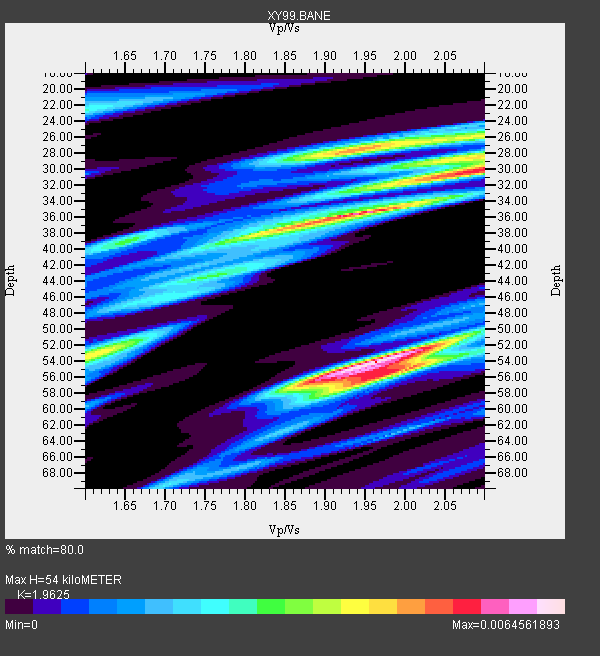
| Thickness Estimate: | 54 km |
| Thickness StdDev: | 12 km |
| Vp/Vs Estimate: | 1.96 |
| Vp/Vs StdDev: | 0.16 |
| Vs Estimate: | 3.15 km/s |
| Poisson's Ratio: | 0.32 |
| Peak Value: | 0.01 |
| Assumed Vp: | 6.183 km/s |
| Ps Weight: | 0.33333334 |
| PpPs Weight: | 0.33333334 |
| PsPs Weight: | 0.33333328 |
| Residual Complexity: | 0.854 |
| Nearby stations H: | +- |
| (2.0 deg) Vp/Vs: | +- |
3 with match > 90% ( 42.857143 %) and 7 with match > 80% ( 100.0 %) out of 7.
Download stack as xyz text file.
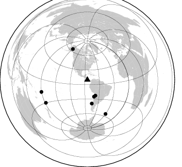
Azimuth Distribution of Events:
Prior Results for this Station
| Study | Thickness | Vp/Vs | Vp | Vs | Poissons Ratio | Extra |
| EARS | 54 km | 1.96 | 6.183 km/s | 3.15 km/s | 0.32 | |
| Crust2.0 | 23 km | 1.81 | 6.183 km/s | 3.422 km/s | 0.28 | S1,continental slope, margin, transition 1 km seds. |
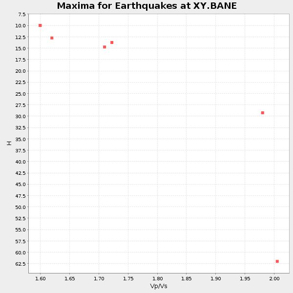
| Global Maxima | 54 km | 1.96 | 6.183 km/s | 3.15 km/s | 0.32 | amp=0.0064561893 |
| Local Maxima 1 | 36 km | 1.94 | 6.183 km/s | 3.191 km/s | 0.32 | amp=0.00574775 |
| Local Maxima 2 | 28 km | 1.94 | 6.183 km/s | 3.191 km/s | 0.32 | amp=0.0048187887 |
| Local Maxima 3 | 55 km | 2.01 | 6.183 km/s | 3.084 km/s | 0.33 | amp=0.004607526 |
| Local Maxima 4 | 30 km | 2.10 | 6.183 km/s | 2.948 km/s | 0.35 | amp=0.004333132 |
| Predicted Arrivals for vertical incidence (zero ray parameter) | |
| Ps | 8.41 SECOND |
| PpPs | 25.87 SECOND |
| PsPs/PpSs | 34.28 SECOND |
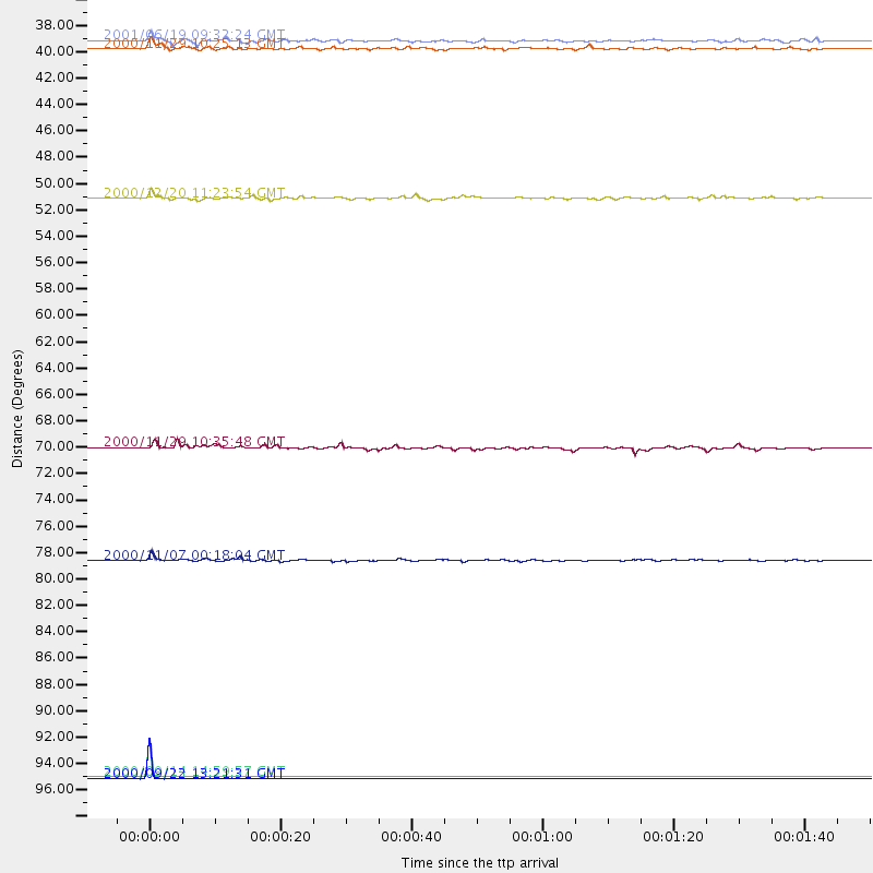
Events Processed for this Station
Download zip of receiver functions as SAC
Plot maxima for each earthquake.
Events Used in the Stack
(7 events)| Radial Match | Distance | Baz | FERegion | Time | Lat/Lon | Depth | Magnitude |
| 100.0 | 97.8 deg | 241.089 deg | Kermadec Islands, New Zealand | 2000/09/22 13:21:31 GMT | (-29.8, -178.4) | 156 km | 5.2 MB, 5.5 MW, 5.5 MW |
| 99.99994 | 97.6 deg | 255.356 deg | Fiji Islands | 2000/09/14 14:59:57 GMT | (-15.7, 179.8) | 33 km | 5.7 MB, 6.2 MS, 6.3 MW, 6.2 MW |
| 91.32046 | 79.7 deg | 151.793 deg | South Sandwich Islands Region | 2000/11/07 00:18:04 GMT | (-55.6, -29.9) | 10 km | 6.7 MS, 6.8 MW, 6.6 MW |
| 85.81759 | 37.2 deg | 158.582 deg | Near Coast Of Northern Chile | 2000/11/29 10:25:13 GMT | (-24.9, -70.9) | 58 km | 5.8 MB, 5.9 MS, 6.4 MW, 6.3 MW |
| 82.93529 | 49.6 deg | 169.468 deg | Off Coast Of Central Chile | 2000/12/20 11:23:54 GMT | (-39.0, -74.7) | 11 km | 6.1 MB, 6.2 MS, 6.4 MW, 6.0 ME |
| 81.274956 | 36.5 deg | 152.899 deg | Chile-Bolivia Border Region | 2001/06/19 09:32:24 GMT | (-22.7, -67.9) | 147 km | 5.5 MB, 5.2 MS, 6.1 MW, 5.9 MW |
| 80.48507 | 70.3 deg | 334.746 deg | Central Alaska | 2000/11/29 10:35:48 GMT | (63.9, -150.1) | 22 km | 5.5 MB, 5.3 MS, 6.0 ML, 5.9 MW |
Losers
(0 events)| Radial Match | Distance | Baz | FERegion | Time | Lat/Lon | Depth | Magnitude | Reason |
