
Station XZ S08 - Tawi Atair
Network: XZ03 - DHOFAR Seismic Experiment
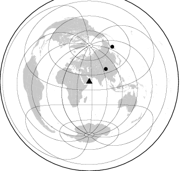
Nearby stations (2 deg radius)
| Station | Name | (Lat, Lon) | Start / End | Elevation |
| S08 | Tawi Atair | (17.11, 54.52) | 2003-03-18 / 2003-08-25 | 658 m |
| Crust2 Type: | S1,continental slope, margin, transition 1 km seds. |
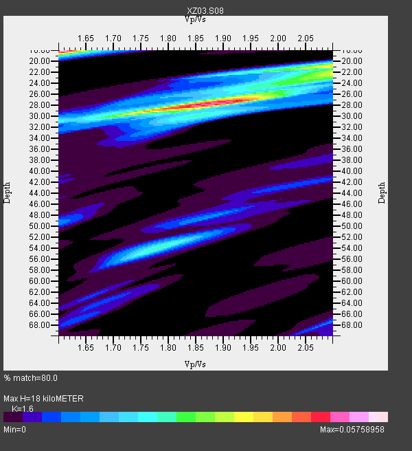
| Thickness Estimate: | 18 km |
| Thickness StdDev: | 23 km |
| Vp/Vs Estimate: | 1.60 |
| Vp/Vs StdDev: | 0.23 |
| Vs Estimate: | 3.864 km/s |
| Poisson's Ratio: | 0.18 |
| Peak Value: | 0.06 |
| Assumed Vp: | 6.183 km/s |
| Ps Weight: | 0.33333334 |
| PpPs Weight: | 0.33333334 |
| PsPs Weight: | 0.33333328 |
| Residual Complexity: | 0.964 |
| Nearby stations H: | +- |
| (2.0 deg) Vp/Vs: | +- |
1 with match > 90% ( 25.0 %) and 2 with match > 80% ( 50.0 %) out of 4.
Download stack as xyz text file.
Azimuth Distribution of Events:
Prior Results for this Station
| Study | Thickness | Vp/Vs | Vp | Vs | Poissons Ratio | Extra |
| EARS | 18 km | 1.60 | 6.183 km/s | 3.864 km/s | 0.18 | |
| Crust2.0 | 23 km | 1.81 | 6.183 km/s | 3.422 km/s | 0.28 | S1,continental slope, margin, transition 1 km seds. |
| Global Maxima | 18 km | 1.60 | 6.183 km/s | 3.864 km/s | 0.18 | amp=0.05758958 |
| Local Maxima 1 | 28 km | 1.87 | 6.183 km/s | 3.302 km/s | 0.30 | amp=0.051639162 |
| Local Maxima 2 | 21 km | 2.10 | 6.183 km/s | 2.948 km/s | 0.35 | amp=0.03719091 |
| Local Maxima 3 | 54 km | 1.77 | 6.183 km/s | 3.483 km/s | 0.27 | amp=0.023624094 |
| Local Maxima 4 | 22 km | 2.10 | 6.183 km/s | 2.948 km/s | 0.35 | amp=0.02067028 |
| Predicted Arrivals for vertical incidence (zero ray parameter) | |
| Ps | 1.75 SECOND |
| PpPs | 7.57 SECOND |
| PsPs/PpSs | 9.32 SECOND |
Events Processed for this Station
Download zip of receiver functions as SAC
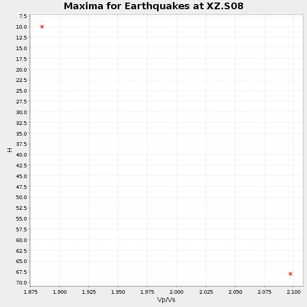
Plot maxima for each earthquake.
Events Used in the Stack
(2 events)| Radial Match | Distance | Baz | FERegion | Time | Lat/Lon | Depth | Magnitude |
| 91.33705 | 42.0 deg | 52.545 deg | Qinghai, China | 2003/04/17 00:48:38 GMT | (37.5, 96.5) | 14 km | 6.2 MB, 6.3 MS, 6.4 MW, 6.2 MW |
| 82.74214 | 84.5 deg | 33.434 deg | Kamchatka Peninsula, Russia | 2003/06/16 22:08:02 GMT | (55.5, 160.0) | 175 km | 6.3 MB, 6.9 MW, 6.9 MW |
Losers
(2 events)| Radial Match | Distance | Baz | FERegion | Time | Lat/Lon | Depth | Magnitude | Reason |
| 66.41052 | 48.9 deg | 304.311 deg | Northern Algeria | 2003/05/27 17:11:28 GMT | (36.9, 3.6) | 8.0 km | 5.5 MB, 5.5 MS, 5.8 MW, 5.7 MW | |
| 61.952297 | 74.8 deg | 98.211 deg | Seram, Indonesia | 2003/03/30 18:13:34 GMT | (-3.2, 127.5) | 33 km | 5.8 MB, 6.0 MS, 6.2 MW, 6.2 MW |
