
Station YB BB27 - YB.BB27
Network: YB98 - South Africa Seismic Experiment - Kimberley Telemetered Array
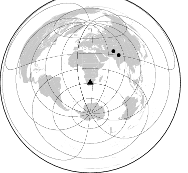
Nearby stations (2 deg radius)
| Station | Name | (Lat, Lon) | Start / End | Elevation |
| BB27 | YB.BB27 | (-28.67, 24.52) | 1998-12-14 / 1999-07-02 | 1888 m |
| Crust2 Type: | G1,Archean, no seds. |
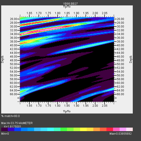
| Thickness Estimate: | 34 km |
| Thickness StdDev: | 4.3 km |
| Vp/Vs Estimate: | 1.62 |
| Vp/Vs StdDev: | 0.12 |
| Vs Estimate: | 3.993 km/s |
| Poisson's Ratio: | 0.19 |
| Peak Value: | 0.04 |
| Assumed Vp: | 6.459 km/s |
| Ps Weight: | 0.33333334 |
| PpPs Weight: | 0.33333334 |
| PsPs Weight: | 0.33333328 |
| Residual Complexity: | 0.829 |
| Nearby stations H: | +- |
| (2.0 deg) Vp/Vs: | +- |
1 with match > 90% ( 25.0 %) and 2 with match > 80% ( 50.0 %) out of 4.
Download stack as xyz text file.
Azimuth Distribution of Events:
Prior Results for this Station
| Study | Thickness | Vp/Vs | Vp | Vs | Poissons Ratio | Extra |
| EARS | 34 km | 1.62 | 6.459 km/s | 3.993 km/s | 0.19 | |
| Crust2.0 | 37 km | 1.76 | 6.459 km/s | 3.665 km/s | 0.26 | G1,Archean, no seds. |
| Global Maxima | 34 km | 1.62 | 6.459 km/s | 3.993 km/s | 0.19 | amp=0.03655692 |
| Local Maxima 1 | 28 km | 1.66 | 6.459 km/s | 3.891 km/s | 0.22 | amp=0.030778801 |
| Local Maxima 2 | 39 km | 1.60 | 6.459 km/s | 4.037 km/s | 0.18 | amp=0.0290847 |
| Local Maxima 3 | 30 km | 1.83 | 6.459 km/s | 3.525 km/s | 0.29 | amp=0.026325593 |
| Local Maxima 4 | 65 km | 1.60 | 6.459 km/s | 4.031 km/s | 0.18 | amp=0.020714652 |
| Predicted Arrivals for vertical incidence (zero ray parameter) | |
| Ps | 3.23 SECOND |
| PpPs | 13.68 SECOND |
| PsPs/PpSs | 16.90 SECOND |
Events Processed for this Station
Download zip of receiver functions as SAC
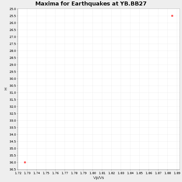
Plot maxima for each earthquake.
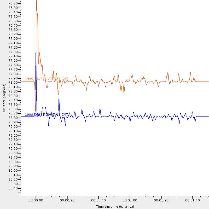
Events Used in the Stack
(2 events)| Radial Match | Distance | Baz | FERegion | Time | Lat/Lon | Depth | Magnitude |
| 93.95218 | 78.7 deg | 46.033 deg | Western Xizang-India Border Reg. | 1999/03/28 19:05:11 GMT | (30.5, 79.4) | 15 km | 6.4 MB, 6.6 MS, 6.6 MW, 6.5 ME |
| 85.27257 | 77.9 deg | 36.541 deg | Hindu Kush Region, Afghanistan | 1999/06/21 17:37:27 GMT | (36.4, 70.7) | 230 km | 5.6 MW, 5.4 MB, 5.5 MW |
Losers
(2 events)| Radial Match | Distance | Baz | FERegion | Time | Lat/Lon | Depth | Magnitude | Reason |
| 56.82317 | 64.3 deg | 79.955 deg | South Indian Ocean | 1999/03/29 06:17:58 GMT | (-4.0, 87.3) | 10 km | 5.5 MS, 5.4 MB, 5.8 MW, 5.8 MW | |
| 53.38819 | 92.8 deg | 285.519 deg | Leeward Islands | 1999/06/08 12:04:00 GMT | (15.0, -60.4) | 55 km | 5.8 MW, 5.3 MS, 5.3 MB, 5.8 MW |
