
Station YJ DZEE - Debre Zeit Veterinary College
Network: YJ01 - Ethiopia-Afar Geoscientific Lithospheric Experiment
Nearby stations (2 deg radius)
| Station | Name | (Lat, Lon) | Start / End | Elevation |
| DZEE | Debre Zeit Veterinary College | (8.78, 39.00) | 2001-11-24 / 2002-12-04 | 1.9 km |
| Crust2 Type: | G9,thin custal Archean 0.1 km seds., South American |
| Thickness Estimate: | 30 km |
| Thickness StdDev: | 8.2 km |
| Vp/Vs Estimate: | 2.10 |
| Vp/Vs StdDev: | 0.13 |
| Vs Estimate: | 3.082 km/s |
| Poisson's Ratio: | 0.35 |
| Peak Value: | 0.02 |
| Assumed Vp: | 6.464 km/s |
| Ps Weight: | 0.33333334 |
| PpPs Weight: | 0.33333334 |
| PsPs Weight: | 0.33333328 |
| Residual Complexity: | 0.786 |
| Nearby stations H: | +- |
| (2.0 deg) Vp/Vs: | +- |
1 with match > 90% ( 16.666666 %) and 6 with match > 80% ( 100.0 %) out of 6.
Download stack as xyz text file.
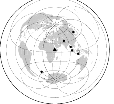
Azimuth Distribution of Events:
Prior Results for this Station
| Study | Thickness | Vp/Vs | Vp | Vs | Poissons Ratio | Extra |
| EARS | 30 km | 2.10 | 6.464 km/s | 3.082 km/s | 0.35 | |
| Crust2.0 | 31 km | 1.76 | 6.464 km/s | 3.663 km/s | 0.26 | G9,thin custal Archean 0.1 km seds., South American |
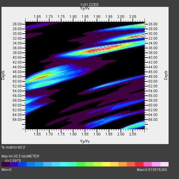
| Global Maxima | 30 km | 2.10 | 6.464 km/s | 3.082 km/s | 0.35 | amp=0.019576265 |
| Local Maxima 1 | 38 km | 1.86 | 6.464 km/s | 3.484 km/s | 0.30 | amp=0.015884206 |
| Local Maxima 2 | 48 km | 1.66 | 6.464 km/s | 3.894 km/s | 0.22 | amp=0.014833655 |
| Local Maxima 3 | 26 km | 2.10 | 6.464 km/s | 3.082 km/s | 0.35 | amp=0.01294494 |
| Local Maxima 4 | 69 km | 2.05 | 6.464 km/s | 3.161 km/s | 0.34 | amp=0.009260988 |
| Predicted Arrivals for vertical incidence (zero ray parameter) | |
| Ps | 5.18 SECOND |
| PpPs | 14.62 SECOND |
| PsPs/PpSs | 19.80 SECOND |
Events Processed for this Station
Download zip of receiver functions as SAC
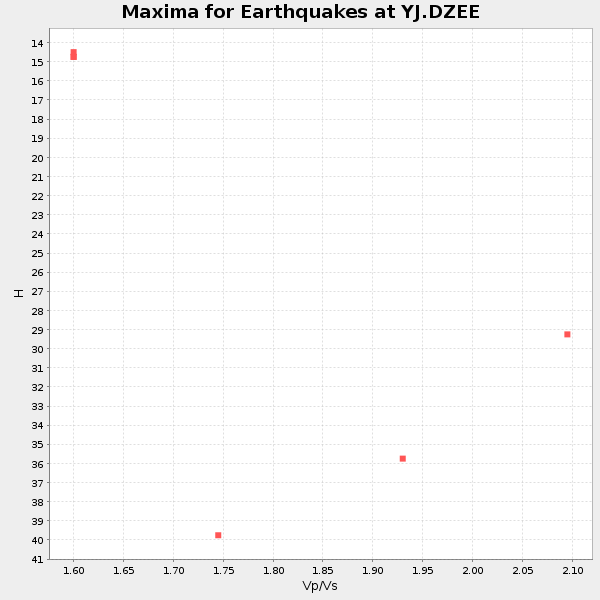
Plot maxima for each earthquake.
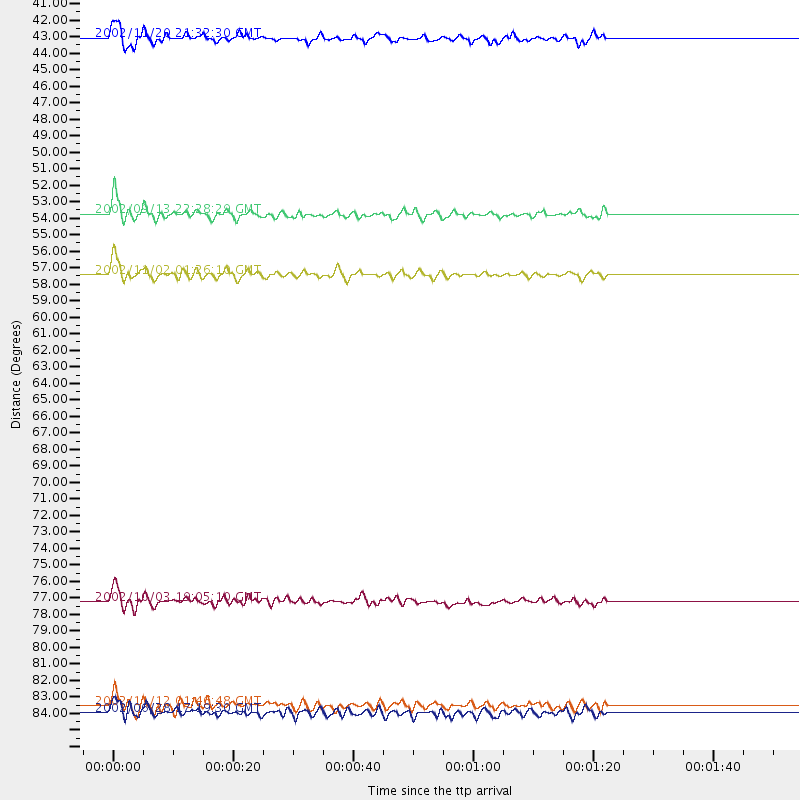
Events Used in the Stack
(6 events)| Radial Match | Distance | Baz | FERegion | Time | Lat/Lon | Depth | Magnitude |
| 91.88862 | 53.2 deg | 80.305 deg | Andaman Islands, India Region | 2002/09/13 22:28:29 GMT | (13.0, 93.1) | 21 km | 6.2 MB, 6.7 MS, 6.5 MW, 6.5 MW |
| 89.29416 | 57.1 deg | 92.317 deg | Northern Sumatra, Indonesia | 2002/11/02 01:26:10 GMT | (2.8, 96.1) | 30 km | 6.2 MB, 7.6 MS, 7.4 MW, 7.4 MW |
| 87.27105 | 78.1 deg | 99.606 deg | Bali Sea | 2002/10/03 19:05:10 GMT | (-7.5, 115.7) | 316 km | 6.0 MB, 6.0 MW, 6.0 MW |
| 84.97484 | 41.9 deg | 45.312 deg | Northwestern Kashmir | 2002/11/20 21:32:30 GMT | (35.4, 74.5) | 33 km | 5.7 MB, 6.5 MS, 6.4 MW, 6.0 MW |
| 82.368 | 84.7 deg | 210.672 deg | South Sandwich Islands Region | 2002/11/12 01:46:48 GMT | (-56.5, -27.5) | 120 km | 6.0 MB, 6.3 MW, 6.2 MW |
| 82.051346 | 85.2 deg | 46.627 deg | E. Russia-N.E. China Border Reg. | 2002/06/28 17:19:30 GMT | (43.8, 130.7) | 566 km | 6.7 MB, 7.3 MW, 7.3 MW |
Losers
(0 events)| Radial Match | Distance | Baz | FERegion | Time | Lat/Lon | Depth | Magnitude | Reason |
