
Station YR ED24 - ROCCASALLI
Network: YR16 - Armatrice Sequence International
Nearby stations (2 deg radius)

| Station | Name | (Lat, Lon) | Start / End | Elevation |
| ED24 | ROCCASALLI | (42.66, 13.19) | 2016-08-30 / 2017-12-16 | 1104 m |
| Crust2 Type: | M5,extended crust, 0.5 km seds. |
| Thickness Estimate: | 54 km |
| Thickness StdDev: | 0.1 km |
| Vp/Vs Estimate: | 1.61 |
| Vp/Vs StdDev: | 0.01 |
| Vs Estimate: | 3.904 km/s |
| Poisson's Ratio: | 0.18 |
| Peak Value: | 0.12 |
| Assumed Vp: | 6.276 km/s |
| Ps Weight: | 0.33333334 |
| PpPs Weight: | 0.33333334 |
| PsPs Weight: | 0.33333328 |
| Residual Complexity: | 0.711 |
| Nearby stations H: | +- |
| (2.0 deg) Vp/Vs: | +- |
0 with match > 90% ( 0.0 %) and 2 with match > 80% ( 18.181818 %) out of 11.
Download stack as xyz text file.
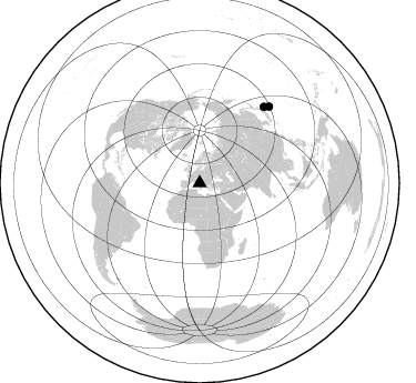
Azimuth Distribution of Events:
Prior Results for this Station
| Study | Thickness | Vp/Vs | Vp | Vs | Poissons Ratio | Extra |
| EARS | 54 km | 1.61 | 6.276 km/s | 3.904 km/s | 0.18 | |
| Crust2.0 | 31 km | 1.78 | 6.276 km/s | 3.529 km/s | 0.27 | M5,extended crust, 0.5 km seds. |
| Global Maxima | 54 km | 1.61 | 6.276 km/s | 3.904 km/s | 0.18 | amp=0.1195545 |
| Local Maxima 1 | 49 km | 2.03 | 6.276 km/s | 3.092 km/s | 0.34 | amp=0.06711989 |
| Local Maxima 2 | 32 km | 1.98 | 6.276 km/s | 3.174 km/s | 0.33 | amp=0.03827176 |
| Local Maxima 3 | 52 km | 2.04 | 6.276 km/s | 3.084 km/s | 0.34 | amp=0.03807941 |
| Local Maxima 4 | 52 km | 1.61 | 6.276 km/s | 3.892 km/s | 0.19 | amp=0.03197079 |
| Predicted Arrivals for vertical incidence (zero ray parameter) | |
| Ps | 5.20 SECOND |
| PpPs | 22.33 SECOND |
| PsPs/PpSs | 27.54 SECOND |
Events Processed for this Station
Download zip of receiver functions as SAC
Plot maxima for each earthquake.
Events Used in the Stack
(2 events)| Radial Match | Distance | Baz | FERegion | Time | Lat/Lon | Depth | Magnitude |
| 86.351 | 89.9 deg | 40.231 deg | Off East Coast Of Honshu, Japan | 2016/09/23 00:14:33 GMT | (34.5, 141.7) | 10 km | 6.4 MWP, 6.3 MWW |
| 80.70689 | 93.3 deg | 42.278 deg | Southeast Of Honshu, Japan | 2016/09/20 16:21:16 GMT | (30.5, 142.1) | 10 km | 6.1 MWW, 6.0 MWB |
Losers
(9 events)| Radial Match | Distance | Baz | FERegion | Time | Lat/Lon | Depth | Magnitude | Reason |
| 84.39206 | 62.9 deg | 69.166 deg | Xizang | 2016/10/17 07:14:50 GMT | (32.9, 94.9) | 32 km | 6.4 MO | |
| 73.868 | 46.5 deg | 154.29 deg | Lake Victoria Region | 2016/09/10 12:27:28 GMT | (-1.0, 31.5) | 10 km | 5.9 MWW, 5.8 MWB, 5.9 MWC | |
| 72.91562 | 85.3 deg | 44.899 deg | Western Honshu, Japan | 2016/10/21 05:07:23 GMT | (35.4, 133.8) | 10 km | 6.2 MWW, 6.6 MI | |
| 70.28603 | 84.8 deg | 30.853 deg | East Of Kuril Islands | 2016/10/23 20:25:26 GMT | (44.0, 148.2) | 30 km | 5.8 MB | |
| 68.46827 | 88.3 deg | 53.434 deg | Ryukyu Islands, Japan | 2016/09/26 05:19:58 GMT | (27.5, 128.6) | 40 km | 6.0 MB | |
| 62.66362 | 84.0 deg | 357.886 deg | Unimak Island Region, Alaska | 2016/10/27 11:53:18 GMT | (53.6, -163.3) | 17 km | 5.8 MWP, 5.8 MI | |
| 61.395767 | 31.1 deg | 81.672 deg | Turkmenistan | 2016/10/26 14:15:40 GMT | (39.5, 54.5) | 0.0 km | 5.4 | |
| 57.97091 | 87.4 deg | 61.449 deg | Taiwan Region | 2016/10/06 15:52:00 GMT | (22.6, 121.4) | 17 km | 5.7 MO | |
| 48.906086 | 68.7 deg | 271.271 deg | Leeward Islands | 2016/10/18 22:08:14 GMT | (15.2, -61.5) | 143 km | 5.6 MWW, 5.6 MWB |

