
Station Z9 W22 - Dual Wheels Farm, Marshallville, GA
Network: Z910 - Southeastern Suture of the Appalachian Margin Experiment
Nearby stations (2 deg radius)
| Station | Name | (Lat, Lon) | Start / End | Elevation |
| W22 | Dual Wheels Farm, Marshallville, GA | (32.45, -83.90) | 2011-05-10 / 2014-05-13 | 133 m |
| Crust2 Type: | DG,thin Platform 1 km seds. |
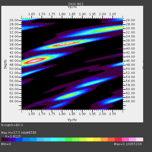
| Thickness Estimate: | 38 km |
| Thickness StdDev: | 4.6 km |
| Vp/Vs Estimate: | 1.81 |
| Vp/Vs StdDev: | 0.11 |
| Vs Estimate: | 3.622 km/s |
| Poisson's Ratio: | 0.28 |
| Peak Value: | 0.11 |
| Assumed Vp: | 6.565 km/s |
| Ps Weight: | 0.33333334 |
| PpPs Weight: | 0.33333334 |
| PsPs Weight: | 0.33333328 |
| Residual Complexity: | 0.713 |
| Nearby stations H: | +- |
| (2.0 deg) Vp/Vs: | +- |
2 with match > 90% ( 20.0 %) and 4 with match > 80% ( 40.0 %) out of 10.
Download stack as xyz text file.
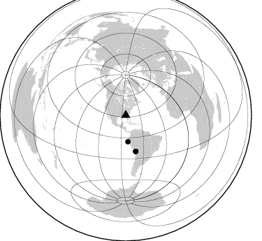
Azimuth Distribution of Events:
Prior Results for this Station
| Study | Thickness | Vp/Vs | Vp | Vs | Poissons Ratio | Extra |
| EARS | 38 km | 1.81 | 6.565 km/s | 3.622 km/s | 0.28 | |
| Crust2.0 | 31 km | 1.78 | 6.565 km/s | 3.684 km/s | 0.27 | DG,thin Platform 1 km seds. |
| Global Maxima | 38 km | 1.81 | 6.565 km/s | 3.622 km/s | 0.28 | amp=0.10955336 |
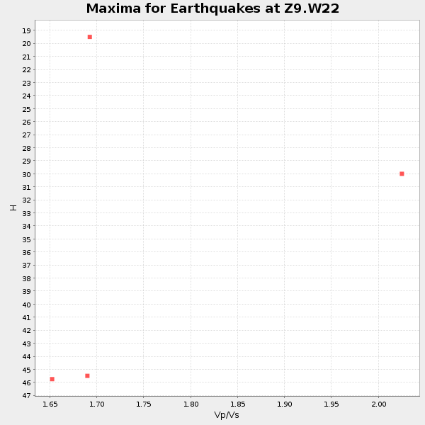
| Local Maxima 1 | 46 km | 1.65 | 6.565 km/s | 3.978 km/s | 0.21 | amp=0.08939807 |
| Local Maxima 2 | 29 km | 2.10 | 6.565 km/s | 3.13 km/s | 0.35 | amp=0.06920864 |
| Local Maxima 3 | 63 km | 1.84 | 6.565 km/s | 3.577 km/s | 0.29 | amp=0.06678707 |
| Local Maxima 4 | 25 km | 1.63 | 6.565 km/s | 4.027 km/s | 0.20 | amp=0.05341011 |
| Predicted Arrivals for vertical incidence (zero ray parameter) | |
| Ps | 4.64 SECOND |
| PpPs | 16.07 SECOND |
| PsPs/PpSs | 20.71 SECOND |
Events Processed for this Station
Download zip of receiver functions as SAC
Plot maxima for each earthquake.
Events Used in the Stack
(4 events)| Radial Match | Distance | Baz | FERegion | Time | Lat/Lon | Depth | Magnitude |
| 95.46511 | 53.6 deg | 164.437 deg | Near Coast Of Northern Chile | 2014/03/16 21:16:30 GMT | (-19.9, -70.6) | 20 km | 6.7 MWW, 6.7 MWC, 7.0 MI |
| 91.977394 | 53.4 deg | 164.669 deg | Near Coast Of Northern Chile | 2014/03/22 12:59:59 GMT | (-19.8, -70.9) | 20 km | 6.2 MWW, 6.2 MWB, 6.3 MWC, 6.4 MWC |
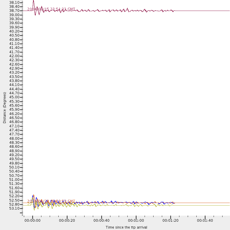
| 88.96431 | 37.9 deg | 175.234 deg | Near Coast Of Northern Peru | 2014/03/15 23:51:33 GMT | (-5.6, -81.0) | 29 km | 6.3 MWW, 6.2 MWB, 6.3 MWC |
| 83.56261 | 53.4 deg | 164.591 deg | Near Coast Of Northern Chile | 2014/03/23 18:20:03 GMT | (-19.7, -70.8) | 35 km | 6.0 MB, 6.2 MWB, 6.2 MWW, 6.3 MWC |
Losers
(6 events)| Radial Match | Distance | Baz | FERegion | Time | Lat/Lon | Depth | Magnitude | Reason |
| 88.587845 | 33.9 deg | 296.183 deg | Off Coast Of Northern California | 2014/03/10 05:18:13 GMT | (40.8, -125.1) | 17 km | 6.8 MW, 6.8 MWR, 6.9 MWW, 6.9 MWB, 7.0 MI, 7.0 MWC | |
| 77.3078 | 47.0 deg | 168.972 deg | Near Coast Of Peru | 2014/02/18 23:35:58 GMT | (-14.2, -75.6) | 57 km | 6.0 MWB, 5.9 MWW, 5.9 MWC, 6.0 MWC | |
| 73.72462 | 46.8 deg | 169.884 deg | Near Coast Of Peru | 2014/03/15 08:59:21 GMT | (-14.1, -76.3) | 20 km | 6.1 MWW, 6.0 MWB, 6.2 MWC | |
| 72.383286 | 80.5 deg | 50.665 deg | Greece | 2014/02/03 03:08:46 GMT | (38.3, 20.4) | 5.0 km | 6.0 MWW, 6.0 MWB, 6.1 MWC | |
| 56.96386 | 63.4 deg | 318.258 deg | Fox Islands, Aleutian Islands | 2014/02/26 21:13:40 GMT | (53.6, -171.8) | 265 km | 6.1 MWW, 5.9 MI, 5.9 ML, 6.1 MWC, 6.1 MWB, 6.2 MWC | |
| 53.307198 | 68.6 deg | 317.668 deg | Andreanof Islands, Aleutian Is. | 2014/01/16 07:33:09 GMT | (51.2, -179.2) | 27 km | 5.5 MWB, 5.2 ML, 5.5 ML, 5.6 MWC |

