
Station ZY A137 - LASSIE A137
Network: ZY90 - Portable Southern California Seismic Networks
Nearby stations (2 deg radius)
| Station | Name | (Lat, Lon) | Start / End | Elevation |
| A137 | LASSIE A137 | (34.00, -118.01) | 2014-09-12 / 2014-11-24 | 326 m |
| Crust2 Type: | M1,extended crust, 3 km seds. |
| Thickness Estimate: | 31 km |
| Thickness StdDev: | 7.3 km |
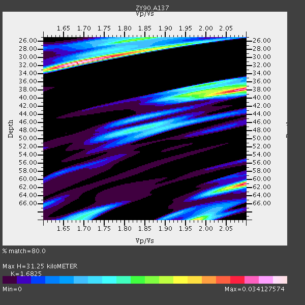
| Vp/Vs Estimate: | 1.68 |
| Vp/Vs StdDev: | 0.10 |
| Vs Estimate: | 3.626 km/s |
| Poisson's Ratio: | 0.23 |
| Peak Value: | 0.03 |
| Assumed Vp: | 6.1 km/s |
| Ps Weight: | 0.33333334 |
| PpPs Weight: | 0.33333334 |
| PsPs Weight: | 0.33333328 |
| Residual Complexity: | 0.823 |
| Nearby stations H: | +- |
| (2.0 deg) Vp/Vs: | +- |
0 with match > 90% ( 0.0 %) and 2 with match > 80% ( 28.571428 %) out of 7.
Download stack as xyz text file.
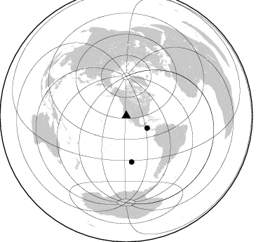
Azimuth Distribution of Events:
Prior Results for this Station
| Study | Thickness | Vp/Vs | Vp | Vs | Poissons Ratio | Extra |
| EARS | 31 km | 1.68 | 6.1 km/s | 3.626 km/s | 0.23 | |
| Crust2.0 | 31 km | 1.78 | 6.1 km/s | 3.426 km/s | 0.27 | M1,extended crust, 3 km seds. |
| Global Maxima | 31 km | 1.68 | 6.1 km/s | 3.626 km/s | 0.23 | amp=0.034127574 |
| Local Maxima 1 | 38 km | 2.09 | 6.1 km/s | 2.922 km/s | 0.35 | amp=0.030458052 |
| Local Maxima 2 | 61 km | 2.10 | 6.1 km/s | 2.912 km/s | 0.35 | amp=0.029490095 |
| Local Maxima 3 | 28 km | 1.86 | 6.1 km/s | 3.28 km/s | 0.30 | amp=0.01858258 |
| Local Maxima 4 | 70 km | 1.98 | 6.1 km/s | 3.085 km/s | 0.33 | amp=0.017070366 |
| Predicted Arrivals for vertical incidence (zero ray parameter) | |
| Ps | 3.50 SECOND |
| PpPs | 13.74 SECOND |
| PsPs/PpSs | 17.24 SECOND |
Events Processed for this Station
Download zip of receiver functions as SAC
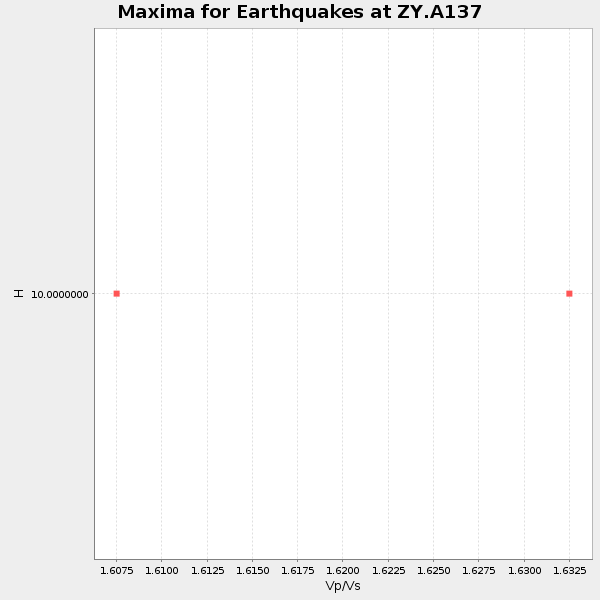
Plot maxima for each earthquake.
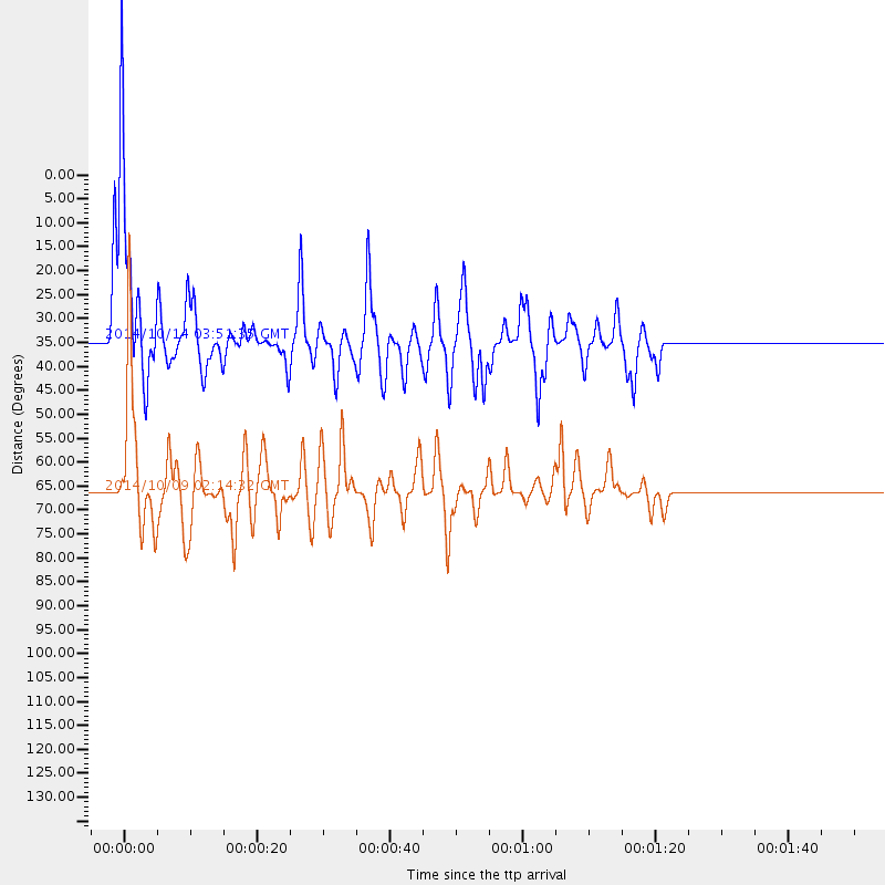
Events Used in the Stack
(2 events)| Radial Match | Distance | Baz | FERegion | Time | Lat/Lon | Depth | Magnitude |
| 85.85139 | 66.1 deg | 173.293 deg | Southern East Pacific Rise | 2014/10/09 02:14:32 GMT | (-32.1, -110.8) | 16 km | 7.1 MWW, 6.8 MI |
| 84.52127 | 34.6 deg | 120.838 deg | Off Coast Of Central America | 2014/10/14 03:51:35 GMT | (12.6, -88.0) | 40 km | 7.3 MWW, 7.4 MI |
Losers
(5 events)| Radial Match | Distance | Baz | FERegion | Time | Lat/Lon | Depth | Magnitude | Reason |
| 78.39314 | 88.1 deg | 227.231 deg | South Of Kermadec Islands | 2014/10/18 09:40:58 GMT | (-33.2, -179.1) | 45 km | 5.0 mb | |
| 69.8933 | 75.5 deg | 132.302 deg | Jujuy Province, Argentina | 2014/09/24 11:16:12 GMT | (-23.9, -66.6) | 189 km | 6.2 MWP, 6.2 MWB, 6.2 MWC | |
| 68.54949 | 66.6 deg | 174.141 deg | Southern East Pacific Rise | 2014/10/09 08:14:23 GMT | (-32.7, -111.6) | 10 km | 5.6 MB | |
| 67.03057 | 50.2 deg | 122.879 deg | Colombia-Ecuador Border Region | 2014/10/20 19:33:21 GMT | (0.6, -77.8) | 10 km | 6.0 MB, 5.6 MWB | |
| 50.30339 | 60.5 deg | 315.516 deg | Kamchatka Peninsula, Russia | 2014/10/02 12:57:06 GMT | (52.4, 158.0) | 150 km | 5.7 MB |

