HIA Hailar, Neimenggu Province, China - Earthquake Result Viewer
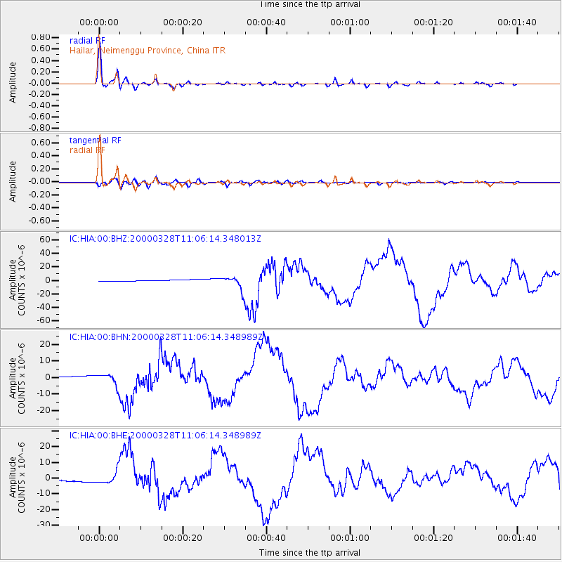
Earthquake location: Volcano Islands, Japan Region
Earthquake latitude/longitude: 22.3/143.7
Earthquake time(UTC): 2000/03/28 (088) 11:00:22 GMT
Earthquake Depth: 126 km
Earthquake Magnitude: 6.8 MB, 7.6 MS, 7.6 MW, 7.6 MW
Earthquake Catalog/Contributor: WHDF/NEIC
Network: IC New China Digital Seismograph Network
Station: HIA Hailar, Neimenggu Province, China
Lat/Lon: 49.27 N/119.74 E
Elevation: 610 m
Distance: 32.9 deg
Az: 330.64 deg
Baz: 136.133 deg
Ray Param: 0.07808087
Estimated Moho Depth: 35.0 km
Estimated Crust Vp/Vs: 1.77
Assumed Crust Vp: 6.577 km/s
Estimated Crust Vs: 3.705 km/s
Estimated Crust Poisson's Ratio: 0.27
Radial Match: 98.15415 %
Radial Bump: 339
Transverse Match: 82.09291 %
Transverse Bump: 400
SOD ConfigId: 3744
Insert Time: 2010-03-04 22:01:57.331 +0000
GWidth: 2.5
Max Bumps: 400
Tol: 0.001

Signal To Noise

ChannelStoNSTALTA
IC:HIA:00:BHN:20000328T11:06:14.348989Z9.2312623.7855896E-64.1008363E-7
IC:HIA:00:BHE:20000328T11:06:14.348989Z8.5107774.1942117E-64.928118E-7
IC:HIA:00:BHZ:20000328T11:06:14.348013Z11.6540621.1383269E-59.767641E-7
Arrivals
Ps4.5 SECOND
PpPs14 SECOND
PsPs/PpSs18 SECOND