HIA Hailar, Neimenggu Province, China - Earthquake Result Viewer
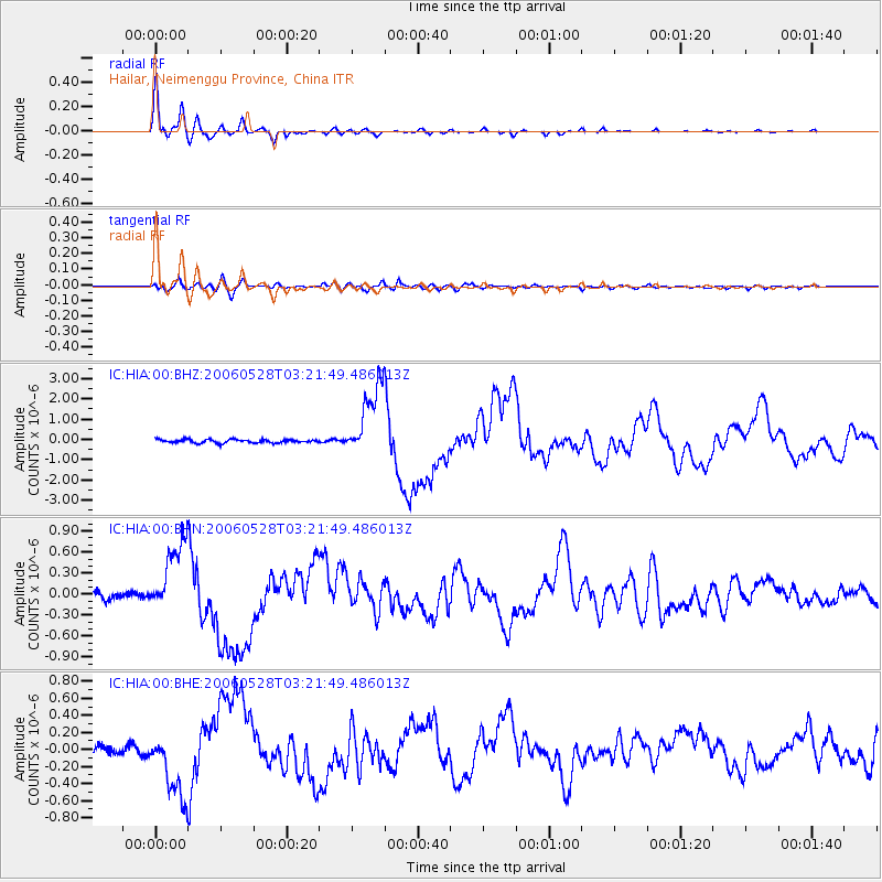
Earthquake location: New Britain Region, P.N.G.
Earthquake latitude/longitude: -5.7/151.1
Earthquake time(UTC): 2006/05/28 (148) 03:12:08 GMT
Earthquake Depth: 34 km
Earthquake Magnitude: 5.9 MB, 6.6 MS, 6.5 MW, 6.4 MW
Earthquake Catalog/Contributor: WHDF/NEIC
Network: IC New China Digital Seismograph Network
Station: HIA Hailar, Neimenggu Province, China
Lat/Lon: 49.27 N/119.74 E
Elevation: 610 m
Distance: 61.2 deg
Az: 337.088 deg
Baz: 143.743 deg
Ray Param: 0.060961466
Estimated Moho Depth: 43.0 km
Estimated Crust Vp/Vs: 1.60
Assumed Crust Vp: 6.577 km/s
Estimated Crust Vs: 4.11 km/s
Estimated Crust Poisson's Ratio: 0.18
Radial Match: 97.88256 %
Radial Bump: 354
Transverse Match: 85.39674 %
Transverse Bump: 400
SOD ConfigId: 2669
Insert Time: 2010-03-04 22:17:25.149 +0000
GWidth: 2.5
Max Bumps: 400
Tol: 0.001

Signal To Noise

ChannelStoNSTALTA
IC:HIA:00:BHN:20060528T03:21:49.486013Z10.9433985.2062217E-74.7574083E-8
IC:HIA:00:BHE:20060528T03:21:49.486013Z8.4870953.9025403E-74.598205E-8
IC:HIA:00:BHZ:20060528T03:21:49.486013Z22.4907631.8375558E-68.1702694E-8
Arrivals
Ps4.1 SECOND
PpPs16 SECOND
PsPs/PpSs20 SECOND