You are here: Home > Network List > IC - New China Digital Seismograph Network Stations List
> Station HIA Hailar, Neimenggu Province, China > Earthquake Result Viewer
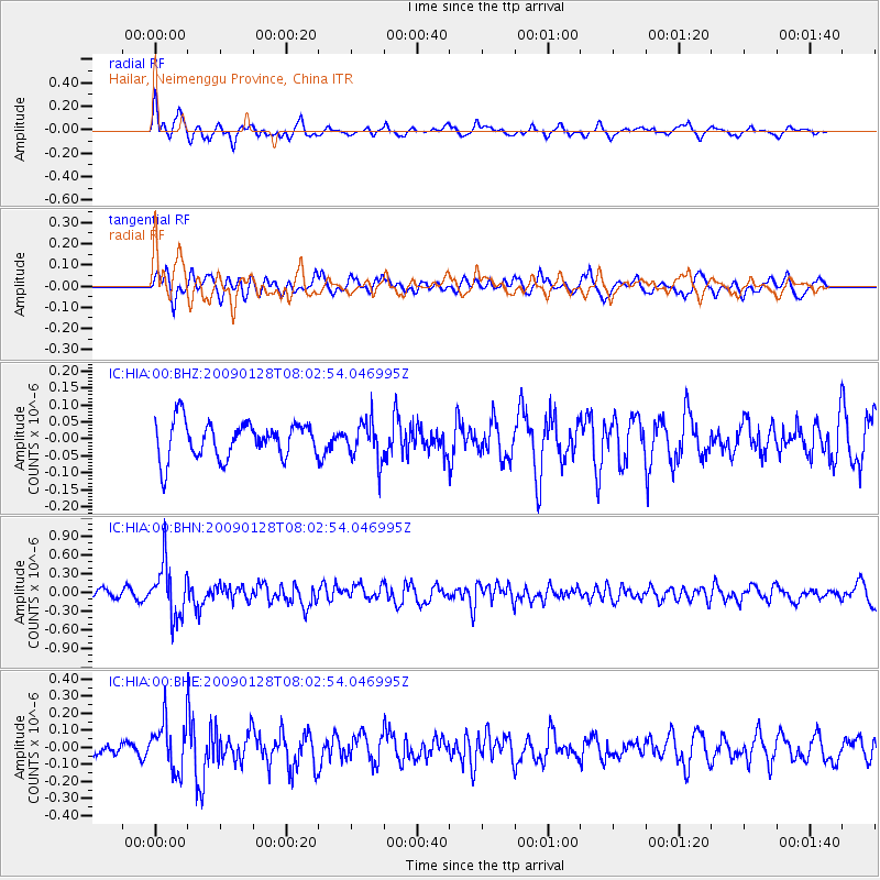
HIA Hailar, Neimenggu Province, China - Earthquake Result Viewer
*The percent match for this event was below the threshold and hence no stack was calculated.
| Earthquake location: |
Timor Region |
| Earthquake latitude/longitude: |
-8.9/124.2 |
| Earthquake time(UTC): |
2009/01/28 (028) 07:53:38 GMT |
| Earthquake Depth: |
66 km |
| Earthquake Magnitude: |
5.6 MB, 5.7 MW, 5.7 MW |
| Earthquake Catalog/Contributor: |
WHDF/NEIC |
|
| Network: |
IC New China Digital Seismograph Network |
| Station: |
HIA Hailar, Neimenggu Province, China |
| Lat/Lon: |
49.27 N/119.74 E |
| Elevation: |
610 m |
|
| Distance: |
58.1 deg |
| Az: |
356.594 deg |
| Baz: |
174.859 deg |
| Ray Param: |
$rayparam |
*The percent match for this event was below the threshold and hence was not used in the summary stack. |
|
| Radial Match: |
70.17423 % |
| Radial Bump: |
400 |
| Transverse Match: |
57.620712 % |
| Transverse Bump: |
400 |
| SOD ConfigId: |
2658 |
| Insert Time: |
2010-03-04 22:18:32.807 +0000 |
| GWidth: |
2.5 |
| Max Bumps: |
400 |
| Tol: |
0.001 |
|
Signal To Noise
| Channel | StoN | STA | LTA |
| IC:HIA:00:BHN:20090128T08:02:54.046995Z | 5.2021337 | 4.2482378E-7 | 8.166337E-8 |
| IC:HIA:00:BHE:20090128T08:02:54.046995Z | 2.8050897 | 1.4898976E-7 | 5.311408E-8 |
| IC:HIA:00:BHZ:20090128T08:02:54.046995Z | 1.0796462 | 5.8063126E-8 | 5.3779768E-8 |
| Arrivals |
| Ps | |
| PpPs | |
| PsPs/PpSs | |


