You are here: Home > Network List > IC - New China Digital Seismograph Network Stations List
> Station HIA Hailar, Neimenggu Province, China > Earthquake Result Viewer
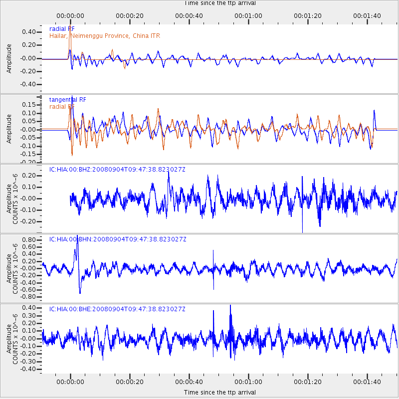
HIA Hailar, Neimenggu Province, China - Earthquake Result Viewer
*The percent match for this event was below the threshold and hence no stack was calculated.
| Earthquake location: |
Santa Cruz Islands |
| Earthquake latitude/longitude: |
-12.1/167.1 |
| Earthquake time(UTC): |
2008/09/04 (248) 09:37:03 GMT |
| Earthquake Depth: |
272 km |
| Earthquake Magnitude: |
5.5 MB, 5.7 MW, 5.6 MW |
| Earthquake Catalog/Contributor: |
WHDF/NEIC |
|
| Network: |
IC New China Digital Seismograph Network |
| Station: |
HIA Hailar, Neimenggu Province, China |
| Lat/Lon: |
49.27 N/119.74 E |
| Elevation: |
610 m |
|
| Distance: |
74.0 deg |
| Az: |
329.911 deg |
| Baz: |
131.544 deg |
| Ray Param: |
$rayparam |
*The percent match for this event was below the threshold and hence was not used in the summary stack. |
|
| Radial Match: |
41.81045 % |
| Radial Bump: |
400 |
| Transverse Match: |
66.3127 % |
| Transverse Bump: |
400 |
| SOD ConfigId: |
2504 |
| Insert Time: |
2010-03-04 22:18:41.025 +0000 |
| GWidth: |
2.5 |
| Max Bumps: |
400 |
| Tol: |
0.001 |
|
Signal To Noise
| Channel | StoN | STA | LTA |
| IC:HIA:00:BHN:20080904T09:47:38.823027Z | 3.9057884 | 3.8760115E-7 | 9.9237624E-8 |
| IC:HIA:00:BHE:20080904T09:47:38.823027Z | 1.124326 | 6.6824164E-8 | 5.9434864E-8 |
| IC:HIA:00:BHZ:20080904T09:47:38.823027Z | 2.1323287 | 9.616376E-8 | 4.5098002E-8 |
| Arrivals |
| Ps | |
| PpPs | |
| PsPs/PpSs | |


