You are here: Home > Network List > IC - New China Digital Seismograph Network Stations List
> Station HIA Hailar, Neimenggu Province, China > Earthquake Result Viewer
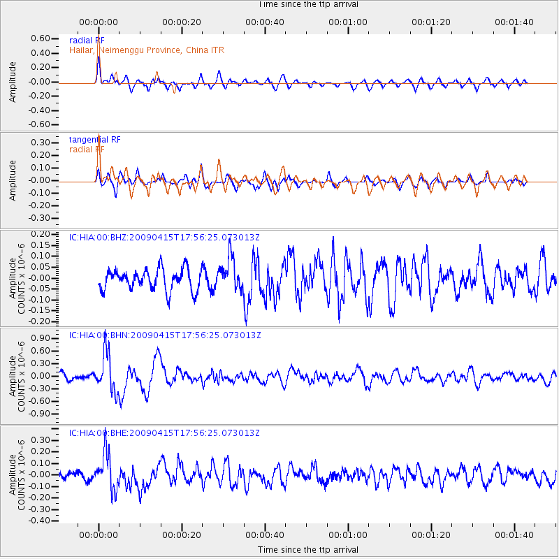
HIA Hailar, Neimenggu Province, China - Earthquake Result Viewer
*The percent match for this event was below the threshold and hence no stack was calculated.
| Earthquake location: |
Southern Sumatra, Indonesia |
| Earthquake latitude/longitude: |
-3.1/100.4 |
| Earthquake time(UTC): |
2009/04/15 (105) 17:47:25 GMT |
| Earthquake Depth: |
6.0 km |
| Earthquake Magnitude: |
5.6 MS, 5.4 MB, 5.8 MW, 5.5 MW |
| Earthquake Catalog/Contributor: |
WHDF/NEIC |
|
| Network: |
IC New China Digital Seismograph Network |
| Station: |
HIA Hailar, Neimenggu Province, China |
| Lat/Lon: |
49.27 N/119.74 E |
| Elevation: |
610 m |
|
| Distance: |
54.8 deg |
| Az: |
15.395 deg |
| Baz: |
203.872 deg |
| Ray Param: |
$rayparam |
*The percent match for this event was below the threshold and hence was not used in the summary stack. |
|
| Radial Match: |
75.96259 % |
| Radial Bump: |
400 |
| Transverse Match: |
58.329376 % |
| Transverse Bump: |
400 |
| SOD ConfigId: |
2658 |
| Insert Time: |
2010-03-04 22:18:46.234 +0000 |
| GWidth: |
2.5 |
| Max Bumps: |
400 |
| Tol: |
0.001 |
|
Signal To Noise
| Channel | StoN | STA | LTA |
| IC:HIA:00:BHN:20090415T17:56:25.073013Z | 5.3930564 | 4.704717E-7 | 8.7236565E-8 |
| IC:HIA:00:BHE:20090415T17:56:25.073013Z | 5.5994267 | 1.6272095E-7 | 2.9060288E-8 |
| IC:HIA:00:BHZ:20090415T17:56:25.073013Z | 1.5817231 | 7.5339564E-8 | 4.763132E-8 |
| Arrivals |
| Ps | |
| PpPs | |
| PsPs/PpSs | |


