You are here: Home > Network List > IC - New China Digital Seismograph Network Stations List
> Station HIA Hailar, Neimenggu Province, China > Earthquake Result Viewer
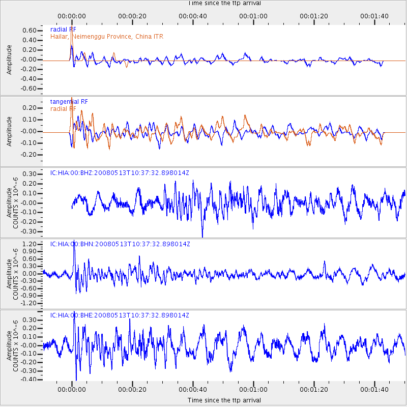
HIA Hailar, Neimenggu Province, China - Earthquake Result Viewer
*The percent match for this event was below the threshold and hence no stack was calculated.
| Earthquake location: |
Northern Sumatra, Indonesia |
| Earthquake latitude/longitude: |
4.7/95.1 |
| Earthquake time(UTC): |
2008/05/13 (134) 10:29:19 GMT |
| Earthquake Depth: |
35 km |
| Earthquake Magnitude: |
5.6 MB, 5.1 MS, 5.4 MW, 5.4 MW |
| Earthquake Catalog/Contributor: |
WHDF/NEIC |
|
| Network: |
IC New China Digital Seismograph Network |
| Station: |
HIA Hailar, Neimenggu Province, China |
| Lat/Lon: |
49.27 N/119.74 E |
| Elevation: |
610 m |
|
| Distance: |
49.1 deg |
| Az: |
21.188 deg |
| Baz: |
213.362 deg |
| Ray Param: |
$rayparam |
*The percent match for this event was below the threshold and hence was not used in the summary stack. |
|
| Radial Match: |
59.747227 % |
| Radial Bump: |
400 |
| Transverse Match: |
49.173088 % |
| Transverse Bump: |
400 |
| SOD ConfigId: |
2504 |
| Insert Time: |
2010-03-04 22:18:52.937 +0000 |
| GWidth: |
2.5 |
| Max Bumps: |
400 |
| Tol: |
0.001 |
|
Signal To Noise
| Channel | StoN | STA | LTA |
| IC:HIA:00:BHN:20080513T10:37:32.898014Z | 6.0117984 | 4.875494E-7 | 8.109877E-8 |
| IC:HIA:00:BHE:20080513T10:37:32.898014Z | 3.3301635 | 1.7150923E-7 | 5.1501743E-8 |
| IC:HIA:00:BHZ:20080513T10:37:32.898014Z | 1.365256 | 8.8757965E-8 | 6.501196E-8 |
| Arrivals |
| Ps | |
| PpPs | |
| PsPs/PpSs | |


