You are here: Home > Network List > IC - New China Digital Seismograph Network Stations List
> Station HIA Hailar, Neimenggu Province, China > Earthquake Result Viewer
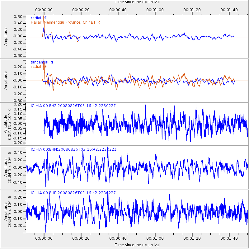
HIA Hailar, Neimenggu Province, China - Earthquake Result Viewer
*The percent match for this event was below the threshold and hence no stack was calculated.
| Earthquake location: |
Sunda Strait, Indonesia |
| Earthquake latitude/longitude: |
-6.3/104.5 |
| Earthquake time(UTC): |
2008/08/26 (239) 03:07:29 GMT |
| Earthquake Depth: |
22 km |
| Earthquake Magnitude: |
5.7 MB, 5.4 MS, 5.7 MW, 5.7 MW |
| Earthquake Catalog/Contributor: |
WHDF/NEIC |
|
| Network: |
IC New China Digital Seismograph Network |
| Station: |
HIA Hailar, Neimenggu Province, China |
| Lat/Lon: |
49.27 N/119.74 E |
| Elevation: |
610 m |
|
| Distance: |
57.0 deg |
| Az: |
11.879 deg |
| Baz: |
198.2 deg |
| Ray Param: |
$rayparam |
*The percent match for this event was below the threshold and hence was not used in the summary stack. |
|
| Radial Match: |
53.983204 % |
| Radial Bump: |
400 |
| Transverse Match: |
46.458954 % |
| Transverse Bump: |
400 |
| SOD ConfigId: |
2504 |
| Insert Time: |
2010-03-04 22:18:57.838 +0000 |
| GWidth: |
2.5 |
| Max Bumps: |
400 |
| Tol: |
0.001 |
|
Signal To Noise
| Channel | StoN | STA | LTA |
| IC:HIA:00:BHN:20080826T03:16:42.223022Z | 2.405284 | 1.92386E-7 | 7.998474E-8 |
| IC:HIA:00:BHE:20080826T03:16:42.223022Z | 2.1808677 | 1.1638094E-7 | 5.3364513E-8 |
| IC:HIA:00:BHZ:20080826T03:16:42.223022Z | 1.0764145 | 6.026576E-8 | 5.5987503E-8 |
| Arrivals |
| Ps | |
| PpPs | |
| PsPs/PpSs | |


