You are here: Home > Network List > IC - New China Digital Seismograph Network Stations List
> Station HIA Hailar, Neimenggu Province, China > Earthquake Result Viewer
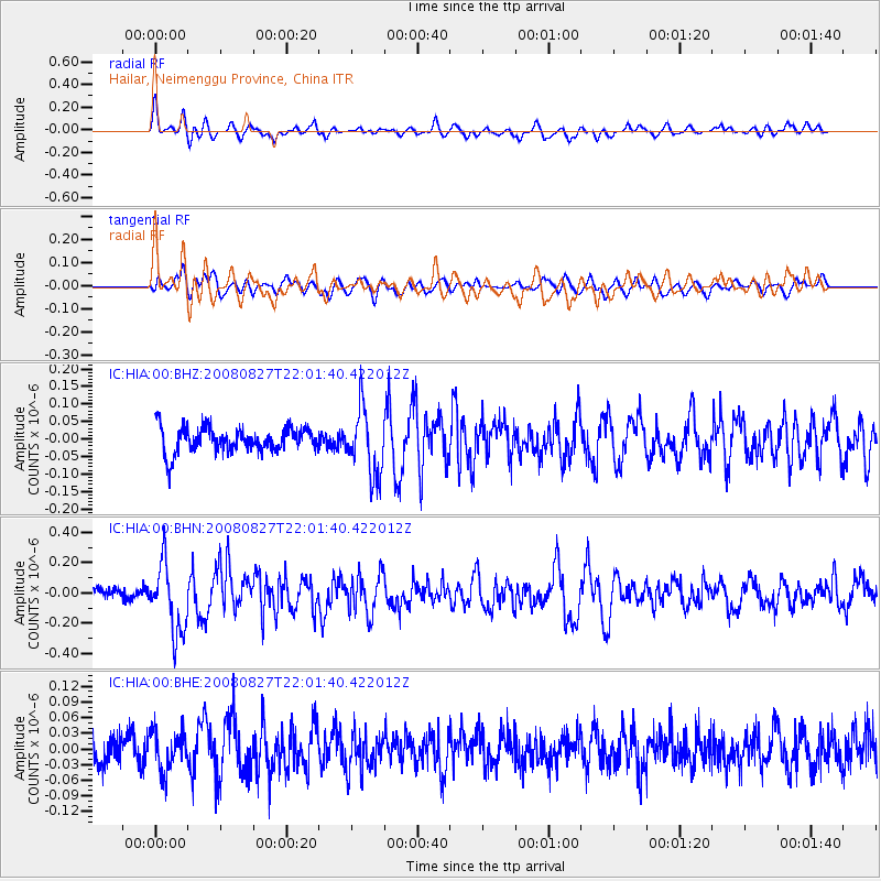
HIA Hailar, Neimenggu Province, China - Earthquake Result Viewer
*The percent match for this event was below the threshold and hence no stack was calculated.
| Earthquake location: |
Iran-Iraq Border Region |
| Earthquake latitude/longitude: |
32.3/47.3 |
| Earthquake time(UTC): |
2008/08/27 (240) 21:52:38 GMT |
| Earthquake Depth: |
10 km |
| Earthquake Magnitude: |
5.5 MS, 5.3 MB, 5.8 MW, 5.7 MW |
| Earthquake Catalog/Contributor: |
WHDF/NEIC |
|
| Network: |
IC New China Digital Seismograph Network |
| Station: |
HIA Hailar, Neimenggu Province, China |
| Lat/Lon: |
49.27 N/119.74 E |
| Elevation: |
610 m |
|
| Distance: |
55.3 deg |
| Az: |
49.438 deg |
| Baz: |
280.862 deg |
| Ray Param: |
$rayparam |
*The percent match for this event was below the threshold and hence was not used in the summary stack. |
|
| Radial Match: |
70.0396 % |
| Radial Bump: |
400 |
| Transverse Match: |
54.25825 % |
| Transverse Bump: |
400 |
| SOD ConfigId: |
2504 |
| Insert Time: |
2010-03-04 22:18:58.580 +0000 |
| GWidth: |
2.5 |
| Max Bumps: |
400 |
| Tol: |
0.001 |
|
Signal To Noise
| Channel | StoN | STA | LTA |
| IC:HIA:00:BHN:20080827T22:01:40.422012Z | 3.5591311 | 2.2685849E-7 | 6.373985E-8 |
| IC:HIA:00:BHE:20080827T22:01:40.422012Z | 1.2186159 | 3.8045133E-8 | 3.121995E-8 |
| IC:HIA:00:BHZ:20080827T22:01:40.422012Z | 2.6217487 | 9.308303E-8 | 3.5504176E-8 |
| Arrivals |
| Ps | |
| PpPs | |
| PsPs/PpSs | |


