You are here: Home > Network List > IC - New China Digital Seismograph Network Stations List
> Station HIA Hailar, Neimenggu Province, China > Earthquake Result Viewer
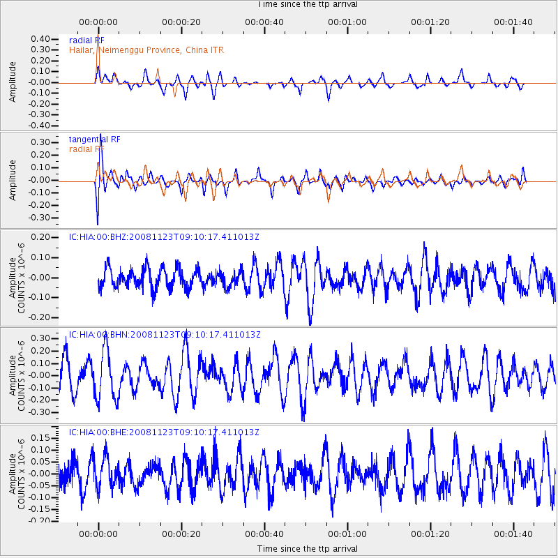
HIA Hailar, Neimenggu Province, China - Earthquake Result Viewer
*The percent match for this event was below the threshold and hence no stack was calculated.
| Earthquake location: |
Southeast Of Loyalty Islands |
| Earthquake latitude/longitude: |
-22.4/171.3 |
| Earthquake time(UTC): |
2008/11/23 (328) 08:58:18 GMT |
| Earthquake Depth: |
40 km |
| Earthquake Magnitude: |
5.6 MW, 5.3 MS, 5.3 MB, 5.5 MW |
| Earthquake Catalog/Contributor: |
WHDF/NEIC |
|
| Network: |
IC New China Digital Seismograph Network |
| Station: |
HIA Hailar, Neimenggu Province, China |
| Lat/Lon: |
49.27 N/119.74 E |
| Elevation: |
610 m |
|
| Distance: |
84.8 deg |
| Az: |
328.982 deg |
| Baz: |
133.294 deg |
| Ray Param: |
$rayparam |
*The percent match for this event was below the threshold and hence was not used in the summary stack. |
|
| Radial Match: |
51.72621 % |
| Radial Bump: |
367 |
| Transverse Match: |
63.451595 % |
| Transverse Bump: |
400 |
| SOD ConfigId: |
2658 |
| Insert Time: |
2010-03-04 22:19:06.512 +0000 |
| GWidth: |
2.5 |
| Max Bumps: |
400 |
| Tol: |
0.001 |
|
Signal To Noise
| Channel | StoN | STA | LTA |
| IC:HIA:00:BHN:20081123T09:10:17.411013Z | 1.8476449 | 2.071476E-7 | 1.1211439E-7 |
| IC:HIA:00:BHE:20081123T09:10:17.411013Z | 1.1600791 | 6.264009E-8 | 5.3996395E-8 |
| IC:HIA:00:BHZ:20081123T09:10:17.411013Z | 0.80986017 | 3.8996667E-8 | 4.8152344E-8 |
| Arrivals |
| Ps | |
| PpPs | |
| PsPs/PpSs | |


