You are here: Home > Network List > IC - New China Digital Seismograph Network Stations List
> Station HIA Hailar, Neimenggu Province, China > Earthquake Result Viewer
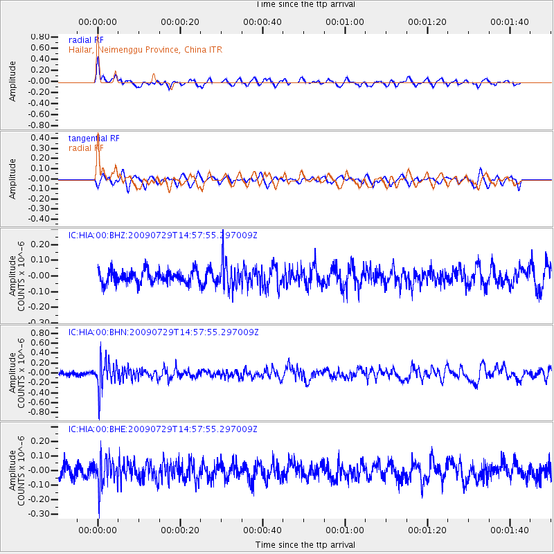
HIA Hailar, Neimenggu Province, China - Earthquake Result Viewer
*The percent match for this event was below the threshold and hence no stack was calculated.
| Earthquake location: |
Volcano Islands, Japan Region |
| Earthquake latitude/longitude: |
22.6/143.3 |
| Earthquake time(UTC): |
2009/07/29 (210) 14:52:08 GMT |
| Earthquake Depth: |
140 km |
| Earthquake Magnitude: |
5.5 MW, 5.2 MB, 5.4 MW |
| Earthquake Catalog/Contributor: |
WHDF/NEIC |
|
| Network: |
IC New China Digital Seismograph Network |
| Station: |
HIA Hailar, Neimenggu Province, China |
| Lat/Lon: |
49.27 N/119.74 E |
| Elevation: |
610 m |
|
| Distance: |
32.5 deg |
| Az: |
330.873 deg |
| Baz: |
136.621 deg |
| Ray Param: |
$rayparam |
*The percent match for this event was below the threshold and hence was not used in the summary stack. |
|
| Radial Match: |
63.321537 % |
| Radial Bump: |
400 |
| Transverse Match: |
45.208984 % |
| Transverse Bump: |
400 |
| SOD ConfigId: |
2622 |
| Insert Time: |
2010-03-04 22:19:07.077 +0000 |
| GWidth: |
2.5 |
| Max Bumps: |
400 |
| Tol: |
0.001 |
|
Signal To Noise
| Channel | StoN | STA | LTA |
| IC:HIA:00:BHN:20090729T14:57:55.297009Z | 5.448004 | 2.8165564E-7 | 5.169887E-8 |
| IC:HIA:00:BHE:20090729T14:57:55.297009Z | 2.1674438 | 9.279333E-8 | 4.2812335E-8 |
| IC:HIA:00:BHZ:20090729T14:57:55.297009Z | 2.0829914 | 8.581893E-8 | 4.119985E-8 |
| Arrivals |
| Ps | |
| PpPs | |
| PsPs/PpSs | |


