You are here: Home > Network List > IC - New China Digital Seismograph Network Stations List
> Station HIA Hailar, Neimenggu Province, China > Earthquake Result Viewer
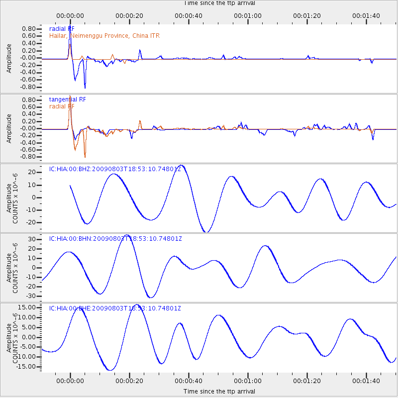
HIA Hailar, Neimenggu Province, China - Earthquake Result Viewer
*The percent match for this event was below the threshold and hence no stack was calculated.
| Earthquake location: |
Gulf Of California |
| Earthquake latitude/longitude: |
29.3/-113.7 |
| Earthquake time(UTC): |
2009/08/03 (215) 18:40:50 GMT |
| Earthquake Depth: |
10 km |
| Earthquake Magnitude: |
5.9 MB, 6.2 MW |
| Earthquake Catalog/Contributor: |
WHDF/NEIC |
|
| Network: |
IC New China Digital Seismograph Network |
| Station: |
HIA Hailar, Neimenggu Province, China |
| Lat/Lon: |
49.27 N/119.74 E |
| Elevation: |
610 m |
|
| Distance: |
88.4 deg |
| Az: |
328.227 deg |
| Baz: |
44.593 deg |
| Ray Param: |
$rayparam |
*The percent match for this event was below the threshold and hence was not used in the summary stack. |
|
| Radial Match: |
93.230644 % |
| Radial Bump: |
400 |
| Transverse Match: |
75.7551 % |
| Transverse Bump: |
400 |
| SOD ConfigId: |
2622 |
| Insert Time: |
2010-03-04 22:19:08.200 +0000 |
| GWidth: |
2.5 |
| Max Bumps: |
400 |
| Tol: |
0.001 |
|
Signal To Noise
| Channel | StoN | STA | LTA |
| IC:HIA:00:BHN:20090803T18:53:10.74801Z | 1.4510512 | 1.4506612E-5 | 9.997312E-6 |
| IC:HIA:00:BHE:20090803T18:53:10.74801Z | 4.0408883 | 1.3402329E-5 | 3.3166789E-6 |
| IC:HIA:00:BHZ:20090803T18:53:10.74801Z | 0.8149587 | 1.0624086E-5 | 1.3036349E-5 |
| Arrivals |
| Ps | |
| PpPs | |
| PsPs/PpSs | |


