You are here: Home > Network List > IC - New China Digital Seismograph Network Stations List
> Station HIA Hailar, Neimenggu Province, China > Earthquake Result Viewer
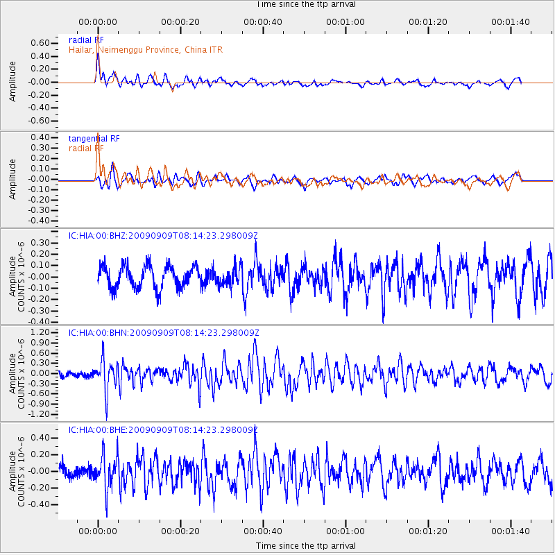
HIA Hailar, Neimenggu Province, China - Earthquake Result Viewer
*The percent match for this event was below the threshold and hence no stack was calculated.
| Earthquake location: |
Northern Molucca Sea |
| Earthquake latitude/longitude: |
2.4/126.0 |
| Earthquake time(UTC): |
2009/09/09 (252) 08:06:33 GMT |
| Earthquake Depth: |
107 km |
| Earthquake Magnitude: |
5.6 MB, 5.7 MW |
| Earthquake Catalog/Contributor: |
WHDF/NEIC |
|
| Network: |
IC New China Digital Seismograph Network |
| Station: |
HIA Hailar, Neimenggu Province, China |
| Lat/Lon: |
49.27 N/119.74 E |
| Elevation: |
610 m |
|
| Distance: |
47.0 deg |
| Az: |
354.385 deg |
| Baz: |
171.418 deg |
| Ray Param: |
$rayparam |
*The percent match for this event was below the threshold and hence was not used in the summary stack. |
|
| Radial Match: |
70.80383 % |
| Radial Bump: |
400 |
| Transverse Match: |
56.31393 % |
| Transverse Bump: |
400 |
| SOD ConfigId: |
2622 |
| Insert Time: |
2010-03-04 22:19:12.776 +0000 |
| GWidth: |
2.5 |
| Max Bumps: |
400 |
| Tol: |
0.001 |
|
Signal To Noise
| Channel | StoN | STA | LTA |
| IC:HIA:00:BHN:20090909T08:14:23.298009Z | 3.21759 | 4.6761568E-7 | 1.4533103E-7 |
| IC:HIA:00:BHE:20090909T08:14:23.298009Z | 3.7900279 | 2.0010114E-7 | 5.279675E-8 |
| IC:HIA:00:BHZ:20090909T08:14:23.298009Z | 0.810142 | 7.855922E-8 | 9.696969E-8 |
| Arrivals |
| Ps | |
| PpPs | |
| PsPs/PpSs | |


