You are here: Home > Network List > IC - New China Digital Seismograph Network Stations List
> Station HIA Hailar, Neimenggu Province, China > Earthquake Result Viewer
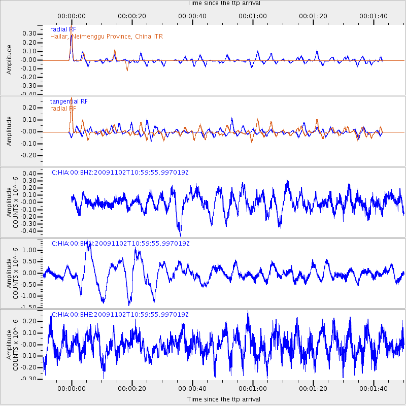
HIA Hailar, Neimenggu Province, China - Earthquake Result Viewer
*The percent match for this event was below the threshold and hence no stack was calculated.
| Earthquake location: |
South Of Tonga Islands |
| Earthquake latitude/longitude: |
-24.1/-175.2 |
| Earthquake time(UTC): |
2009/11/02 (306) 10:47:13 GMT |
| Earthquake Depth: |
9.0 km |
| Earthquake Magnitude: |
6.1 MB, 6.1 MS, 6.2 MW, 6.1 MW |
| Earthquake Catalog/Contributor: |
WHDF/NEIC |
|
| Network: |
IC New China Digital Seismograph Network |
| Station: |
HIA Hailar, Neimenggu Province, China |
| Lat/Lon: |
49.27 N/119.74 E |
| Elevation: |
610 m |
|
| Distance: |
93.1 deg |
| Az: |
323.488 deg |
| Baz: |
123.909 deg |
| Ray Param: |
$rayparam |
*The percent match for this event was below the threshold and hence was not used in the summary stack. |
|
| Radial Match: |
70.161514 % |
| Radial Bump: |
392 |
| Transverse Match: |
51.926327 % |
| Transverse Bump: |
400 |
| SOD ConfigId: |
2622 |
| Insert Time: |
2010-03-04 22:19:16.321 +0000 |
| GWidth: |
2.5 |
| Max Bumps: |
400 |
| Tol: |
0.001 |
|
Signal To Noise
| Channel | StoN | STA | LTA |
| IC:HIA:00:BHN:20091102T10:59:55.997019Z | 4.5132565 | 4.3400118E-7 | 9.616143E-8 |
| IC:HIA:00:BHE:20091102T10:59:55.997019Z | 0.61849403 | 6.727469E-8 | 1.08771765E-7 |
| IC:HIA:00:BHZ:20091102T10:59:55.997019Z | 1.6576675 | 1.0824205E-7 | 6.5297804E-8 |
| Arrivals |
| Ps | |
| PpPs | |
| PsPs/PpSs | |


