You are here: Home > Network List > IC - New China Digital Seismograph Network Stations List
> Station HIA Hailar, Neimenggu Province, China > Earthquake Result Viewer
HIA Hailar, Neimenggu Province, China - Earthquake Result Viewer
*The percent match for this event was below the threshold and hence no stack was calculated.
| Earthquake location: |
Banda Sea |
| Earthquake latitude/longitude: |
-7.5/127.8 |
| Earthquake time(UTC): |
2009/02/26 (057) 21:09:30 GMT |
| Earthquake Depth: |
145 km |
| Earthquake Magnitude: |
5.5 MW, 5.4 MB, 5.5 MW |
| Earthquake Catalog/Contributor: |
WHDF/NEIC |
|
| Network: |
IC New China Digital Seismograph Network |
| Station: |
HIA Hailar, Neimenggu Province, China |
| Lat/Lon: |
49.27 N/119.74 E |
| Elevation: |
610 m |
|
| Distance: |
56.9 deg |
| Az: |
353.731 deg |
| Baz: |
170.485 deg |
| Ray Param: |
$rayparam |
*The percent match for this event was below the threshold and hence was not used in the summary stack. |
|
| Radial Match: |
75.0763 % |
| Radial Bump: |
375 |
| Transverse Match: |
53.104374 % |
| Transverse Bump: |
400 |
| SOD ConfigId: |
2658 |
| Insert Time: |
2010-03-04 22:19:18.838 +0000 |
| GWidth: |
2.5 |
| Max Bumps: |
400 |
| Tol: |
0.001 |
|
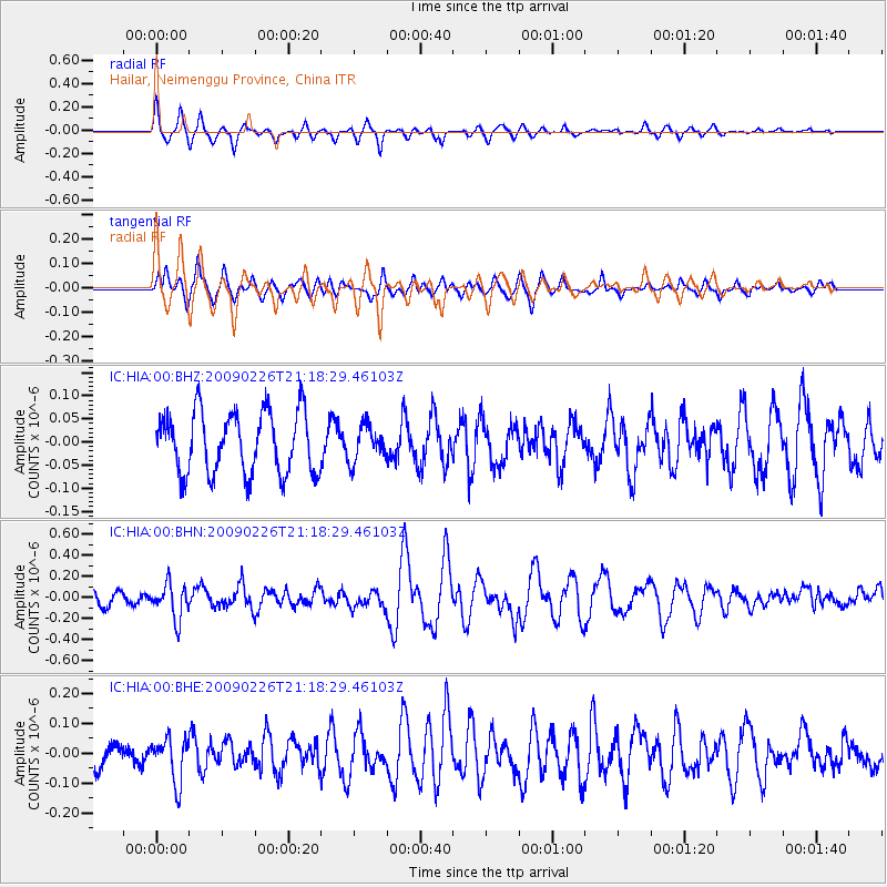
Signal To Noise
| Channel | StoN | STA | LTA |
| IC:HIA:00:BHN:20090226T21:18:29.46103Z | 2.2056577 | 1.634517E-7 | 7.410565E-8 |
| IC:HIA:00:BHE:20090226T21:18:29.46103Z | 1.4807404 | 7.3864655E-8 | 4.9883592E-8 |
| IC:HIA:00:BHZ:20090226T21:18:29.46103Z | 0.5652625 | 3.7600707E-8 | 6.6519014E-8 |
| Arrivals |
| Ps | |
| PpPs | |
| PsPs/PpSs | |


