You are here: Home > Network List > IC - New China Digital Seismograph Network Stations List
> Station HIA Hailar, Neimenggu Province, China > Earthquake Result Viewer
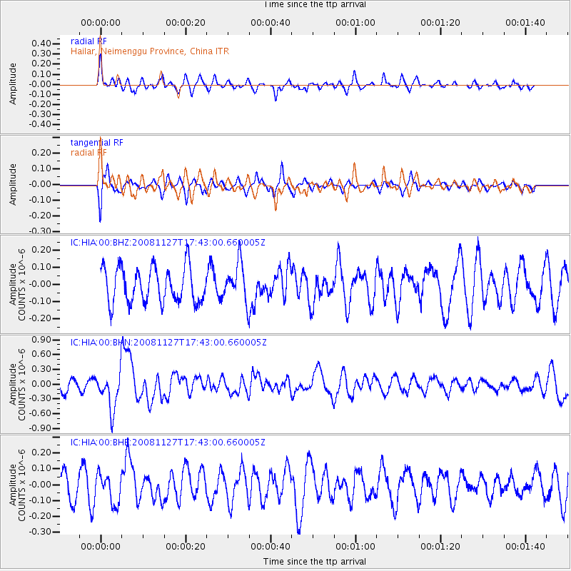
HIA Hailar, Neimenggu Province, China - Earthquake Result Viewer
*The percent match for this event was below the threshold and hence no stack was calculated.
| Earthquake location: |
Vanuatu Islands |
| Earthquake latitude/longitude: |
-17.8/167.6 |
| Earthquake time(UTC): |
2008/11/27 (332) 17:31:27 GMT |
| Earthquake Depth: |
10 km |
| Earthquake Magnitude: |
5.5 MB, 5.3 MS, 5.5 MW |
| Earthquake Catalog/Contributor: |
WHDF/NEIC |
|
| Network: |
IC New China Digital Seismograph Network |
| Station: |
HIA Hailar, Neimenggu Province, China |
| Lat/Lon: |
49.27 N/119.74 E |
| Elevation: |
610 m |
|
| Distance: |
79.1 deg |
| Az: |
330.359 deg |
| Baz: |
134.004 deg |
| Ray Param: |
$rayparam |
*The percent match for this event was below the threshold and hence was not used in the summary stack. |
|
| Radial Match: |
65.41713 % |
| Radial Bump: |
400 |
| Transverse Match: |
57.02646 % |
| Transverse Bump: |
373 |
| SOD ConfigId: |
2658 |
| Insert Time: |
2010-03-04 22:19:19.760 +0000 |
| GWidth: |
2.5 |
| Max Bumps: |
400 |
| Tol: |
0.001 |
|
Signal To Noise
| Channel | StoN | STA | LTA |
| IC:HIA:00:BHN:20081127T17:43:00.660005Z | 3.2340755 | 3.9318883E-7 | 1.2157689E-7 |
| IC:HIA:00:BHE:20081127T17:43:00.660005Z | 1.3261127 | 9.4327575E-8 | 7.113089E-8 |
| IC:HIA:00:BHZ:20081127T17:43:00.660005Z | 1.0974932 | 1.15144346E-7 | 1.0491577E-7 |
| Arrivals |
| Ps | |
| PpPs | |
| PsPs/PpSs | |


