You are here: Home > Network List > IC - New China Digital Seismograph Network Stations List
> Station HIA Hailar, Neimenggu Province, China > Earthquake Result Viewer
HIA Hailar, Neimenggu Province, China - Earthquake Result Viewer
*The percent match for this event was below the threshold and hence no stack was calculated.
| Earthquake location: |
South Of Fiji Islands |
| Earthquake latitude/longitude: |
-22.0/-179.6 |
| Earthquake time(UTC): |
2009/06/07 (158) 12:46:30 GMT |
| Earthquake Depth: |
590 km |
| Earthquake Magnitude: |
5.5 MW, 5.1 MB |
| Earthquake Catalog/Contributor: |
WHDF/NEIC |
|
| Network: |
IC New China Digital Seismograph Network |
| Station: |
HIA Hailar, Neimenggu Province, China |
| Lat/Lon: |
49.27 N/119.74 E |
| Elevation: |
610 m |
|
| Distance: |
89.1 deg |
| Az: |
325.167 deg |
| Baz: |
125.999 deg |
| Ray Param: |
$rayparam |
*The percent match for this event was below the threshold and hence was not used in the summary stack. |
|
| Radial Match: |
50.833847 % |
| Radial Bump: |
400 |
| Transverse Match: |
64.13066 % |
| Transverse Bump: |
400 |
| SOD ConfigId: |
2648 |
| Insert Time: |
2010-03-04 22:19:23.906 +0000 |
| GWidth: |
2.5 |
| Max Bumps: |
400 |
| Tol: |
0.001 |
|
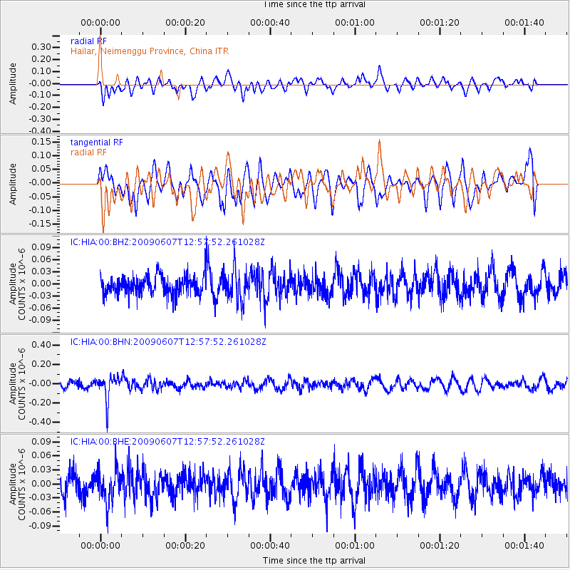
Signal To Noise
| Channel | StoN | STA | LTA |
| IC:HIA:00:BHN:20090607T12:57:52.261028Z | 2.7987008 | 1.292528E-7 | 4.6183143E-8 |
| IC:HIA:00:BHE:20090607T12:57:52.261028Z | 1.7178172 | 3.5382257E-8 | 2.059722E-8 |
| IC:HIA:00:BHZ:20090607T12:57:52.261028Z | 1.7433928 | 3.960908E-8 | 2.271954E-8 |
| Arrivals |
| Ps | |
| PpPs | |
| PsPs/PpSs | |


