You are here: Home > Network List > IC - New China Digital Seismograph Network Stations List
> Station HIA Hailar, Neimenggu Province, China > Earthquake Result Viewer
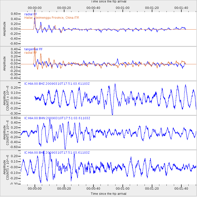
HIA Hailar, Neimenggu Province, China - Earthquake Result Viewer
*The percent match for this event was below the threshold and hence no stack was calculated.
| Earthquake location: |
Near North Coast Of Irian Jaya |
| Earthquake latitude/longitude: |
-1.9/139.1 |
| Earthquake time(UTC): |
2009/03/10 (069) 17:42:14 GMT |
| Earthquake Depth: |
18 km |
| Earthquake Magnitude: |
5.5 MB, 5.2 MS, 5.5 MW, 5.4 MW |
| Earthquake Catalog/Contributor: |
WHDF/NEIC |
|
| Network: |
IC New China Digital Seismograph Network |
| Station: |
HIA Hailar, Neimenggu Province, China |
| Lat/Lon: |
49.27 N/119.74 E |
| Elevation: |
610 m |
|
| Distance: |
53.6 deg |
| Az: |
344.34 deg |
| Baz: |
155.679 deg |
| Ray Param: |
$rayparam |
*The percent match for this event was below the threshold and hence was not used in the summary stack. |
|
| Radial Match: |
62.27537 % |
| Radial Bump: |
375 |
| Transverse Match: |
31.00646 % |
| Transverse Bump: |
327 |
| SOD ConfigId: |
2658 |
| Insert Time: |
2010-03-04 22:19:24.433 +0000 |
| GWidth: |
2.5 |
| Max Bumps: |
400 |
| Tol: |
0.001 |
|
Signal To Noise
| Channel | StoN | STA | LTA |
| IC:HIA:00:BHN:20090310T17:51:03.61103Z | 4.262234 | 2.753199E-7 | 6.4595206E-8 |
| IC:HIA:00:BHE:20090310T17:51:03.61103Z | 1.6013017 | 1.4023264E-7 | 8.757416E-8 |
| IC:HIA:00:BHZ:20090310T17:51:03.61103Z | 1.2616967 | 1.1025393E-7 | 8.7385445E-8 |
| Arrivals |
| Ps | |
| PpPs | |
| PsPs/PpSs | |


