You are here: Home > Network List > IC - New China Digital Seismograph Network Stations List
> Station HIA Hailar, Neimenggu Province, China > Earthquake Result Viewer
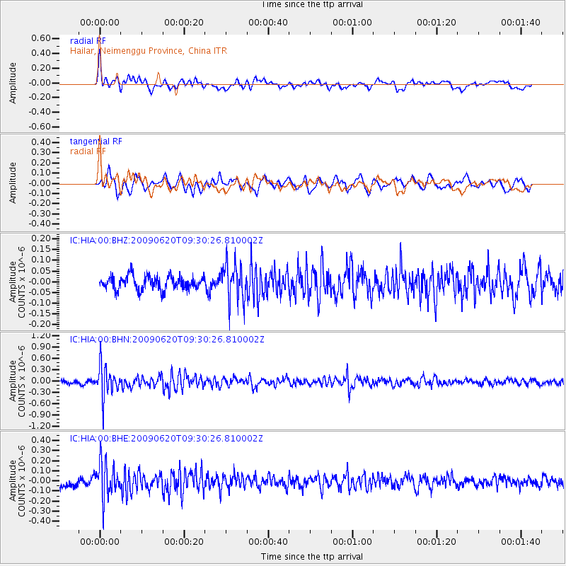
HIA Hailar, Neimenggu Province, China - Earthquake Result Viewer
*The percent match for this event was below the threshold and hence no stack was calculated.
| Earthquake location: |
Southern Sumatra, Indonesia |
| Earthquake latitude/longitude: |
-5.0/103.0 |
| Earthquake time(UTC): |
2009/06/20 (171) 09:21:23 GMT |
| Earthquake Depth: |
46 km |
| Earthquake Magnitude: |
5.8 MB, 5.4 MW, 5.4 MW |
| Earthquake Catalog/Contributor: |
WHDF/NEIC |
|
| Network: |
IC New China Digital Seismograph Network |
| Station: |
HIA Hailar, Neimenggu Province, China |
| Lat/Lon: |
49.27 N/119.74 E |
| Elevation: |
610 m |
|
| Distance: |
56.0 deg |
| Az: |
13.125 deg |
| Baz: |
200.203 deg |
| Ray Param: |
$rayparam |
*The percent match for this event was below the threshold and hence was not used in the summary stack. |
|
| Radial Match: |
66.803925 % |
| Radial Bump: |
400 |
| Transverse Match: |
64.55067 % |
| Transverse Bump: |
400 |
| SOD ConfigId: |
2648 |
| Insert Time: |
2010-03-04 22:19:27.522 +0000 |
| GWidth: |
2.5 |
| Max Bumps: |
400 |
| Tol: |
0.001 |
|
Signal To Noise
| Channel | StoN | STA | LTA |
| IC:HIA:00:BHN:20090620T09:30:26.810002Z | 10.087082 | 4.0473236E-7 | 4.0123826E-8 |
| IC:HIA:00:BHE:20090620T09:30:26.810002Z | 4.7576075 | 1.7386485E-7 | 3.6544595E-8 |
| IC:HIA:00:BHZ:20090620T09:30:26.810002Z | 2.7070696 | 8.600955E-8 | 3.1772196E-8 |
| Arrivals |
| Ps | |
| PpPs | |
| PsPs/PpSs | |


