You are here: Home > Network List > IC - New China Digital Seismograph Network Stations List
> Station HIA Hailar, Neimenggu Province, China > Earthquake Result Viewer
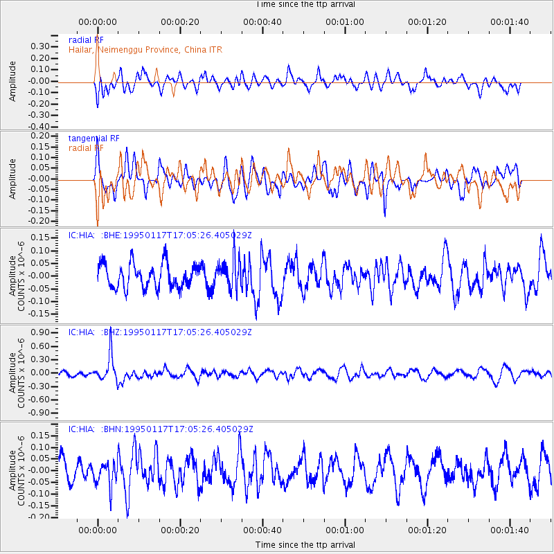
HIA Hailar, Neimenggu Province, China - Earthquake Result Viewer
*The percent match for this event was below the threshold and hence no stack was calculated.
| Earthquake location: |
Fiji Islands Region |
| Earthquake latitude/longitude: |
-20.9/-179.2 |
| Earthquake time(UTC): |
1995/01/17 (017) 16:54:12 GMT |
| Earthquake Depth: |
637 km |
| Earthquake Magnitude: |
6.0 MB, 6.2 UNKNOWN, 6.4 MW |
| Earthquake Catalog/Contributor: |
WHDF/NEIC |
|
| Network: |
IC New China Digital Seismograph Network |
| Station: |
HIA Hailar, Neimenggu Province, China |
| Lat/Lon: |
49.27 N/119.74 E |
| Elevation: |
610 m |
|
| Distance: |
88.3 deg |
| Az: |
325.016 deg |
| Baz: |
125.061 deg |
| Ray Param: |
$rayparam |
*The percent match for this event was below the threshold and hence was not used in the summary stack. |
|
| Radial Match: |
60.96339 % |
| Radial Bump: |
400 |
| Transverse Match: |
45.91201 % |
| Transverse Bump: |
400 |
| SOD ConfigId: |
4480 |
| Insert Time: |
2010-03-04 22:19:31.790 +0000 |
| GWidth: |
2.5 |
| Max Bumps: |
400 |
| Tol: |
0.001 |
|
Signal To Noise
| Channel | StoN | STA | LTA |
| IC:HIA: :BHZ:19950117T17:05:26.405029Z | 3.6227963 | 3.0522074E-7 | 8.425005E-8 |
| IC:HIA: :BHN:19950117T17:05:26.405029Z | 1.1390035 | 5.3306618E-8 | 4.68011E-8 |
| IC:HIA: :BHE:19950117T17:05:26.405029Z | 1.2799132 | 6.11812E-8 | 4.7801056E-8 |
| Arrivals |
| Ps | |
| PpPs | |
| PsPs/PpSs | |


