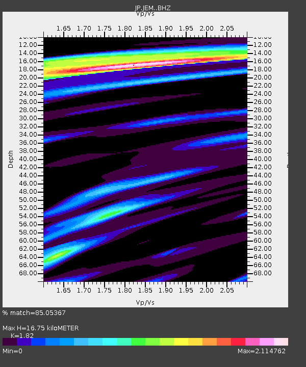
JEM Erimo - Earthquake Result Viewer

Earthquake location: Andreanof Islands, Aleutian Is.
Earthquake latitude/longitude: 51.6/-174.0
Earthquake time(UTC): 2016/03/12 (072) 18:06:45 GMT
Earthquake Depth: 19 km
Earthquake Magnitude: 6.3 MWW, 6.1 MB, 6.2 MWB, 6.3 MWC, 6.4 MWC, 6.4 MI
Earthquake Catalog/Contributor: NEIC PDE/NEIC COMCAT
Network: JP Japan Meteorological Agency Seismic Network
Station: JEM Erimo
Lat/Lon: 42.02 N/143.15 E
Elevation: 40 m
Distance: 30.4 deg
Az: 268.789 deg
Baz: 56.881 deg
Ray Param: 0.07932123
Estimated Moho Depth: 16.75 km
Estimated Crust Vp/Vs: 1.82
Assumed Crust Vp: 6.461 km/s
Estimated Crust Vs: 3.55 km/s
Estimated Crust Poisson's Ratio: 0.28
Radial Match: 85.05367 %
Radial Bump: 400
Transverse Match: 77.50696 %
Transverse Bump: 400
SOD ConfigId: 7422571
Insert Time: 2019-04-22 00:41:15.276 +0000
GWidth: 2.5
Max Bumps: 400
Tol: 0.001

Signal To Noise

ChannelStoNSTALTA
JP:JEM: :BHZ:20160312T18:12:25.900011Z8.72553351.3975495E-61.6016779E-7
JP:JEM: :BHN:20160312T18:12:25.900011Z2.63327965.1104024E-71.940699E-7
JP:JEM: :BHE:20160312T18:12:25.900011Z4.32446056.904413E-71.5965954E-7
Arrivals
Ps2.3 SECOND
PpPs6.8 SECOND
PsPs/PpSs9.1 SECOND