You are here: Home > Network List > LD - Lamont-Doherty Cooperative Seismographic Network Stations List
> Station MIDE Milford, DE, USA > Earthquake Result Viewer
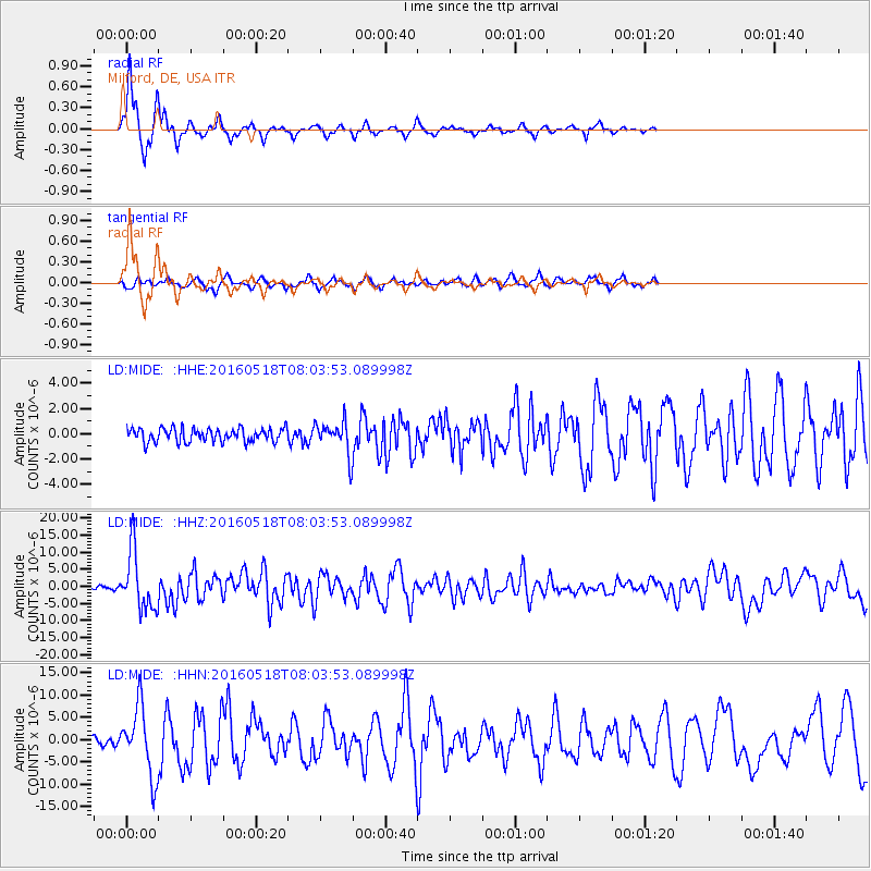
MIDE Milford, DE, USA - Earthquake Result Viewer

| Earthquake location: |
Near Coast Of Ecuador |
| Earthquake latitude/longitude: |
0.4/-79.8 |
| Earthquake time(UTC): |
2016/05/18 (139) 07:57:05 GMT |
| Earthquake Depth: |
32 km |
| Earthquake Magnitude: |
6.7 MWP, 6.7 MWW, 6.7 MI |
| Earthquake Catalog/Contributor: |
NEIC PDE/NEIC COMCAT |
|
| Network: |
LD Lamont-Doherty Cooperative Seismographic Network |
| Station: |
MIDE Milford, DE, USA |
| Lat/Lon: |
38.88 N/75.33 W |
| Elevation: |
5.0 m |
|
| Distance: |
38.5 deg |
| Az: |
5.571 deg |
| Baz: |
187.145 deg |
| Ray Param: |
0.07547397 |
| Estimated Moho Depth: |
16.0 km |
| Estimated Crust Vp/Vs: |
1.73 |
| Assumed Crust Vp: |
6.287 km/s |
| Estimated Crust Vs: |
3.629 km/s |
| Estimated Crust Poisson's Ratio: |
0.25 |
|
| Radial Match: |
91.930954 % |
| Radial Bump: |
262 |
| Transverse Match: |
72.971535 % |
| Transverse Bump: |
400 |
| SOD ConfigId: |
7422571 |
| Insert Time: |
2019-04-22 14:38:53.835 +0000 |
| GWidth: |
2.5 |
| Max Bumps: |
400 |
| Tol: |
0.001 |
|
Signal To Noise
| Channel | StoN | STA | LTA |
| LD:MIDE: :HHZ:20160518T08:03:53.089998Z | 21.453367 | 8.626615E-6 | 4.021101E-7 |
| LD:MIDE: :HHN:20160518T08:03:53.089998Z | 11.841815 | 7.684773E-6 | 6.4895227E-7 |
| LD:MIDE: :HHE:20160518T08:03:53.089998Z | 2.4594586 | 1.3337293E-6 | 5.422857E-7 |
| Arrivals |
| Ps | 2.0 SECOND |
| PpPs | 6.5 SECOND |
| PsPs/PpSs | 8.5 SECOND |


