You are here: Home > Network List > TA - USArray Transportable Network (new EarthScope stations) Stations List
> Station L02F Cave Junction, OR, USA > Earthquake Result Viewer
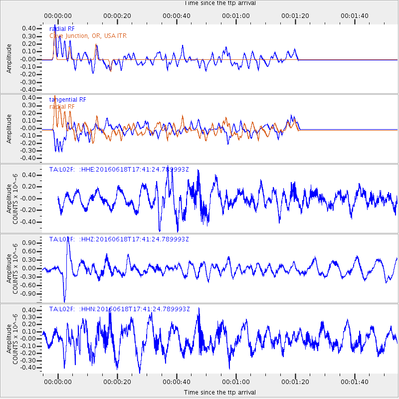
L02F Cave Junction, OR, USA - Earthquake Result Viewer
*The percent match for this event was below the threshold and hence no stack was calculated.
| Earthquake location: |
Chile-Argentina Border Region |
| Earthquake latitude/longitude: |
-24.2/-67.1 |
| Earthquake time(UTC): |
2016/06/18 (170) 17:29:44 GMT |
| Earthquake Depth: |
167 km |
| Earthquake Magnitude: |
5.5 MB |
| Earthquake Catalog/Contributor: |
NEIC PDE/NEIC COMCAT |
|
| Network: |
TA USArray Transportable Network (new EarthScope stations) |
| Station: |
L02F Cave Junction, OR, USA |
| Lat/Lon: |
42.12 N/123.57 W |
| Elevation: |
440 m |
|
| Distance: |
84.1 deg |
| Az: |
321.424 deg |
| Baz: |
130.068 deg |
| Ray Param: |
$rayparam |
*The percent match for this event was below the threshold and hence was not used in the summary stack. |
|
| Radial Match: |
63.748096 % |
| Radial Bump: |
400 |
| Transverse Match: |
61.66075 % |
| Transverse Bump: |
400 |
| SOD ConfigId: |
7422571 |
| Insert Time: |
2019-04-22 21:06:37.832 +0000 |
| GWidth: |
2.5 |
| Max Bumps: |
400 |
| Tol: |
0.001 |
|
Signal To Noise
| Channel | StoN | STA | LTA |
| TA:L02F: :HHZ:20160618T17:41:24.789993Z | 7.2503347 | 5.6283716E-7 | 7.7629124E-8 |
| TA:L02F: :HHN:20160618T17:41:24.789993Z | 1.8184619 | 1.4173604E-7 | 7.7942815E-8 |
| TA:L02F: :HHE:20160618T17:41:24.789993Z | 1.9354289 | 2.1170857E-7 | 1.0938587E-7 |
| Arrivals |
| Ps | |
| PpPs | |
| PsPs/PpSs | |


