You are here: Home > Network List > TA - USArray Transportable Network (new EarthScope stations) Stations List
> Station L02F Cave Junction, OR, USA > Earthquake Result Viewer
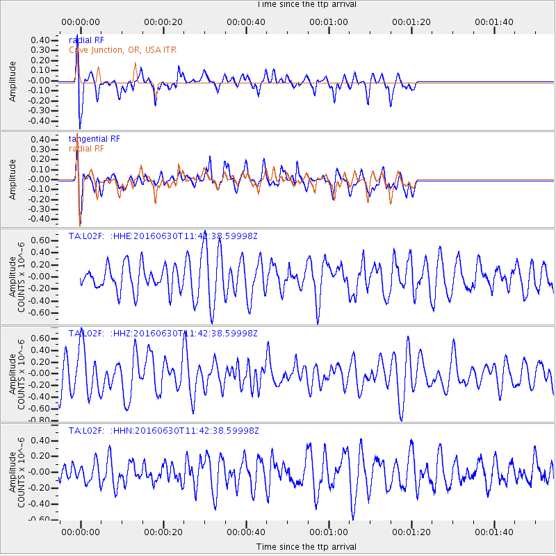
L02F Cave Junction, OR, USA - Earthquake Result Viewer
*The percent match for this event was below the threshold and hence no stack was calculated.
| Earthquake location: |
Vanuatu Islands |
| Earthquake latitude/longitude: |
-16.1/167.4 |
| Earthquake time(UTC): |
2016/06/30 (182) 11:30:34 GMT |
| Earthquake Depth: |
40 km |
| Earthquake Magnitude: |
5.8 MB |
| Earthquake Catalog/Contributor: |
NEIC PDE/NEIC COMCAT |
|
| Network: |
TA USArray Transportable Network (new EarthScope stations) |
| Station: |
L02F Cave Junction, OR, USA |
| Lat/Lon: |
42.12 N/123.57 W |
| Elevation: |
440 m |
|
| Distance: |
85.9 deg |
| Az: |
44.139 deg |
| Baz: |
244.138 deg |
| Ray Param: |
$rayparam |
*The percent match for this event was below the threshold and hence was not used in the summary stack. |
|
| Radial Match: |
69.3593 % |
| Radial Bump: |
400 |
| Transverse Match: |
67.033134 % |
| Transverse Bump: |
400 |
| SOD ConfigId: |
11737051 |
| Insert Time: |
2019-04-25 00:23:31.670 +0000 |
| GWidth: |
2.5 |
| Max Bumps: |
400 |
| Tol: |
0.001 |
|
Signal To Noise
| Channel | StoN | STA | LTA |
| TA:L02F: :HHZ:20160630T11:42:38.59998Z | 1.7660784 | 4.1034997E-7 | 2.3235096E-7 |
| TA:L02F: :HHN:20160630T11:42:38.59998Z | 0.5879093 | 1.226662E-7 | 2.0864817E-7 |
| TA:L02F: :HHE:20160630T11:42:38.59998Z | 2.504399 | 5.080399E-7 | 2.02859E-7 |
| Arrivals |
| Ps | |
| PpPs | |
| PsPs/PpSs | |


