You are here: Home > Network List > TA - USArray Transportable Network (new EarthScope stations) Stations List
> Station L02F Cave Junction, OR, USA > Earthquake Result Viewer
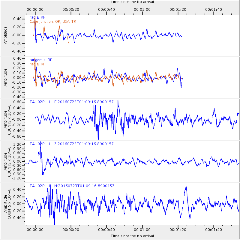
L02F Cave Junction, OR, USA - Earthquake Result Viewer
*The percent match for this event was below the threshold and hence no stack was calculated.
| Earthquake location: |
Northwest Of Kuril Islands |
| Earthquake latitude/longitude: |
47.7/147.0 |
| Earthquake time(UTC): |
2016/07/23 (205) 01:00:21 GMT |
| Earthquake Depth: |
407 km |
| Earthquake Magnitude: |
5.7 MB |
| Earthquake Catalog/Contributor: |
NEIC PDE/NEIC ALERT |
|
| Network: |
TA USArray Transportable Network (new EarthScope stations) |
| Station: |
L02F Cave Junction, OR, USA |
| Lat/Lon: |
42.12 N/123.57 W |
| Elevation: |
440 m |
|
| Distance: |
60.2 deg |
| Az: |
59.04 deg |
| Baz: |
308.879 deg |
| Ray Param: |
$rayparam |
*The percent match for this event was below the threshold and hence was not used in the summary stack. |
|
| Radial Match: |
61.03881 % |
| Radial Bump: |
400 |
| Transverse Match: |
45.00925 % |
| Transverse Bump: |
400 |
| SOD ConfigId: |
11737051 |
| Insert Time: |
2019-04-25 03:16:10.313 +0000 |
| GWidth: |
2.5 |
| Max Bumps: |
400 |
| Tol: |
0.001 |
|
Signal To Noise
| Channel | StoN | STA | LTA |
| TA:L02F: :HHZ:20160723T01:09:16.890015Z | 4.0521607 | 5.3210545E-7 | 1.3131401E-7 |
| TA:L02F: :HHN:20160723T01:09:16.890015Z | 1.0881908 | 1.3594841E-7 | 1.2493066E-7 |
| TA:L02F: :HHE:20160723T01:09:16.890015Z | 1.7899166 | 2.0483725E-7 | 1.1443955E-7 |
| Arrivals |
| Ps | |
| PpPs | |
| PsPs/PpSs | |


