You are here: Home > Network List > TA - USArray Transportable Network (new EarthScope stations) Stations List
> Station L02F Cave Junction, OR, USA > Earthquake Result Viewer
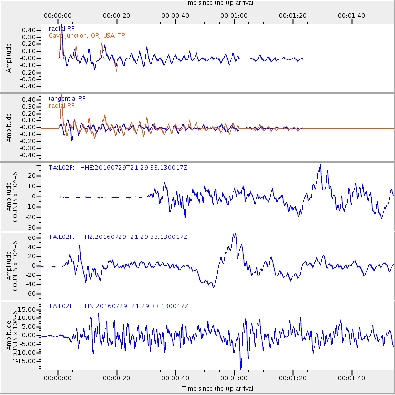
L02F Cave Junction, OR, USA - Earthquake Result Viewer
*The percent match for this event was below the threshold and hence no stack was calculated.
| Earthquake location: |
Mariana Islands |
| Earthquake latitude/longitude: |
18.5/145.5 |
| Earthquake time(UTC): |
2016/07/29 (211) 21:18:25 GMT |
| Earthquake Depth: |
212 km |
| Earthquake Magnitude: |
7.7 MWW, 7.7 MWB, 7.7 MI |
| Earthquake Catalog/Contributor: |
NEIC PDE/NEIC COMCAT |
|
| Network: |
TA USArray Transportable Network (new EarthScope stations) |
| Station: |
L02F Cave Junction, OR, USA |
| Lat/Lon: |
42.12 N/123.57 W |
| Elevation: |
440 m |
|
| Distance: |
78.5 deg |
| Az: |
49.393 deg |
| Baz: |
284.467 deg |
| Ray Param: |
$rayparam |
*The percent match for this event was below the threshold and hence was not used in the summary stack. |
|
| Radial Match: |
97.43911 % |
| Radial Bump: |
400 |
| Transverse Match: |
79.35816 % |
| Transverse Bump: |
400 |
| SOD ConfigId: |
11737051 |
| Insert Time: |
2019-04-25 05:02:06.576 +0000 |
| GWidth: |
2.5 |
| Max Bumps: |
400 |
| Tol: |
0.001 |
|
Signal To Noise
| Channel | StoN | STA | LTA |
| TA:L02F: :HHZ:20160729T21:29:33.130017Z | 27.38172 | 9.33519E-6 | 3.409278E-7 |
| TA:L02F: :HHN:20160729T21:29:33.130017Z | 4.2722025 | 1.1707755E-6 | 2.7404494E-7 |
| TA:L02F: :HHE:20160729T21:29:33.130017Z | 8.0310955 | 2.8353252E-6 | 3.530434E-7 |
| Arrivals |
| Ps | |
| PpPs | |
| PsPs/PpSs | |


