
COR Corvallis, Oregon, USA - Earthquake Result Viewer
| ||||||||||||||||||
| ||||||||||||||||||
| ||||||||||||||||||
|
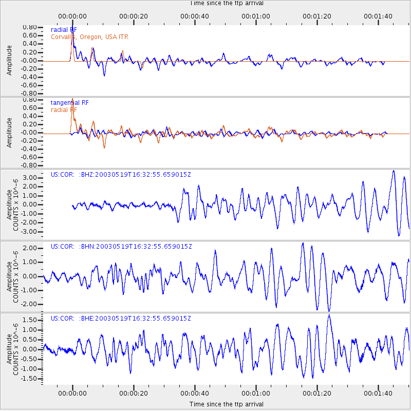
Signal To Noise
| Channel | StoN | STA | LTA |
| US:COR: :BHN:20030519T16:32:55.659015Z | 1.2270248 | 2.9150482E-7 | 2.3757042E-7 |
| US:COR: :BHE:20030519T16:32:55.659015Z | 1.1649456 | 2.620552E-7 | 2.249506E-7 |
| US:COR: :BHZ:20030519T16:32:55.659015Z | 3.136279 | 6.6179666E-7 | 2.1101333E-7 |
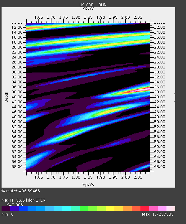
| Arrivals | |
| Ps | 6.5 SECOND |
| PpPs | 16 SECOND |
| PsPs/PpSs | 22 SECOND |

