COR Corvallis, Oregon, USA - Earthquake Result Viewer
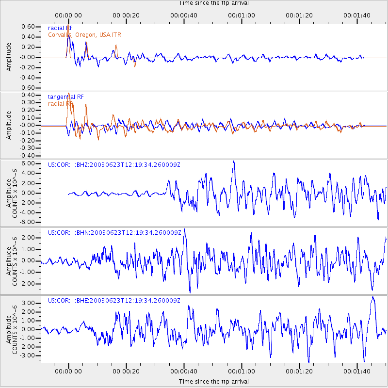
Earthquake location: Rat Islands, Aleutian Islands
Earthquake latitude/longitude: 51.4/176.8
Earthquake time(UTC): 2003/06/23 (174) 12:12:34 GMT
Earthquake Depth: 20 km
Earthquake Magnitude: 6.3 MB, 7.0 MS, 6.9 MW, 6.8 MW
Earthquake Catalog/Contributor: WHDF/NEIC
Network: US United States National Seismic Network
Station: COR Corvallis, Oregon, USA
Lat/Lon: 44.59 N/123.30 W
Elevation: 121 m
Distance: 39.7 deg
Az: 75.621 deg
Baz: 301.951 deg
Ray Param: 0.0748294
Estimated Moho Depth: 36.5 km
Estimated Crust Vp/Vs: 2.04
Assumed Crust Vp: 6.566 km/s
Estimated Crust Vs: 3.215 km/s
Estimated Crust Poisson's Ratio: 0.34
Radial Match: 87.699905 %
Radial Bump: 400
Transverse Match: 72.919975 %
Transverse Bump: 400
SOD ConfigId: 110177
Insert Time: 2010-03-05 06:38:22.627 +0000
GWidth: 2.5
Max Bumps: 400
Tol: 0.001

Signal To Noise

ChannelStoNSTALTA
US:COR: :BHN:20030623T12:19:34.260009Z1.82868642.57637E-71.4088639E-7
US:COR: :BHE:20030623T12:19:34.260009Z1.77275693.1729374E-71.7898323E-7
US:COR: :BHZ:20030623T12:19:34.260009Z3.3141358.333029E-72.5143905E-7
Arrivals
Ps6.2 SECOND
PpPs16 SECOND
PsPs/PpSs22 SECOND