
COR Corvallis, Oregon, USA - Earthquake Result Viewer
| ||||||||||||||||||
| ||||||||||||||||||
| ||||||||||||||||||
|
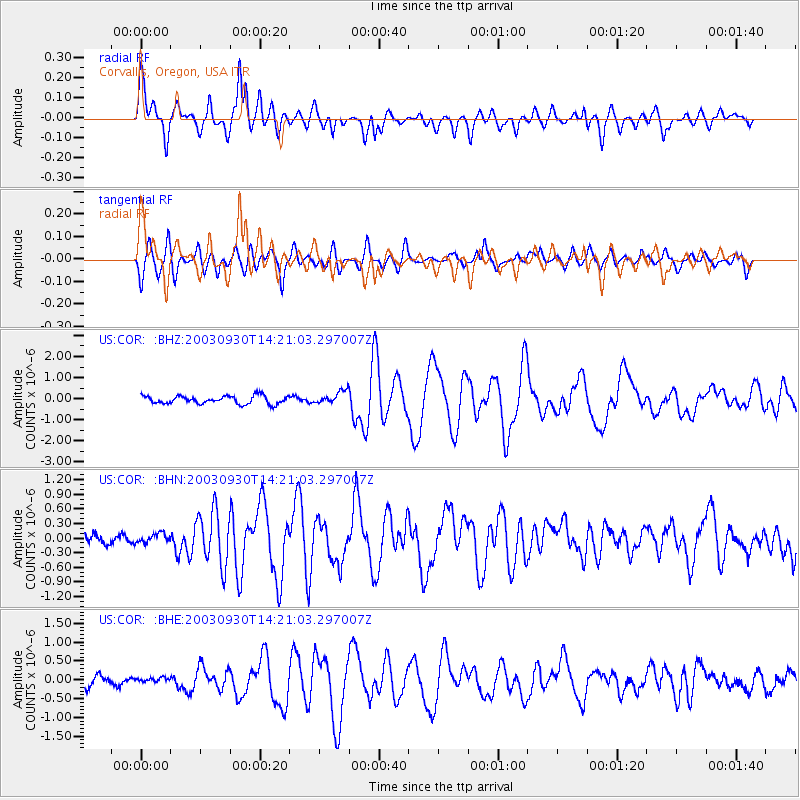
Signal To Noise
| Channel | StoN | STA | LTA |
| US:COR: :BHN:20030930T14:21:03.297007Z | 0.6961231 | 9.491021E-8 | 1.3634113E-7 |
| US:COR: :BHE:20030930T14:21:03.297007Z | 0.29188618 | 5.6622895E-8 | 1.9398964E-7 |
| US:COR: :BHZ:20030930T14:21:03.297007Z | 1.610915 | 3.0435402E-7 | 1.889324E-7 |
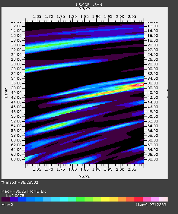
| Arrivals | |
| Ps | 6.2 SECOND |
| PpPs | 17 SECOND |
| PsPs/PpSs | 23 SECOND |

