You are here: Home > Network List > US - United States National Seismic Network Stations List
> Station CCM Cathedral Cave, Missouri, USA > Earthquake Result Viewer
CCM Cathedral Cave, Missouri, USA - Earthquake Result Viewer

| Earthquake location: |
Fiji Islands Region |
| Earthquake latitude/longitude: |
-16.2/-176.2 |
| Earthquake time(UTC): |
2004/01/11 (011) 08:07:04 GMT |
| Earthquake Depth: |
366 km |
| Earthquake Magnitude: |
5.3 MB, 5.9 MW, 5.9 MW |
| Earthquake Catalog/Contributor: |
WHDF/NEIC |
|
| Network: |
US United States National Seismic Network |
| Station: |
CCM Cathedral Cave, Missouri, USA |
| Lat/Lon: |
38.06 N/91.24 W |
| Elevation: |
222 m |
|
| Distance: |
95.9 deg |
| Az: |
52.24 deg |
| Baz: |
254.161 deg |
| Ray Param: |
0.040303137 |
| Estimated Moho Depth: |
14.25 km |
| Estimated Crust Vp/Vs: |
1.62 |
| Assumed Crust Vp: |
6.498 km/s |
| Estimated Crust Vs: |
3.998 km/s |
| Estimated Crust Poisson's Ratio: |
0.20 |
|
| Radial Match: |
82.12594 % |
| Radial Bump: |
400 |
| Transverse Match: |
53.379967 % |
| Transverse Bump: |
400 |
| SOD ConfigId: |
7314 |
| Insert Time: |
2010-03-05 06:51:01.933 +0000 |
| GWidth: |
2.5 |
| Max Bumps: |
400 |
| Tol: |
0.001 |
|
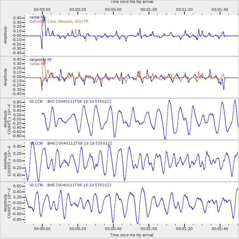
Signal To Noise
| Channel | StoN | STA | LTA |
| US:CCM: :BHN:20040111T08:19:19.535012Z | 0.83612263 | 2.2482618E-7 | 2.688914E-7 |
| US:CCM: :BHE:20040111T08:19:19.535012Z | 1.53463 | 2.5360367E-7 | 1.6525395E-7 |
| US:CCM: :BHZ:20040111T08:19:19.535012Z | 1.3892077 | 4.1773419E-7 | 3.0069958E-7 |
| Arrivals |
| Ps | 1.4 SECOND |
| PpPs | 5.6 SECOND |
| PsPs/PpSs | 7.0 SECOND |


