CCM Cathedral Cave, Missouri, USA - Earthquake Result Viewer
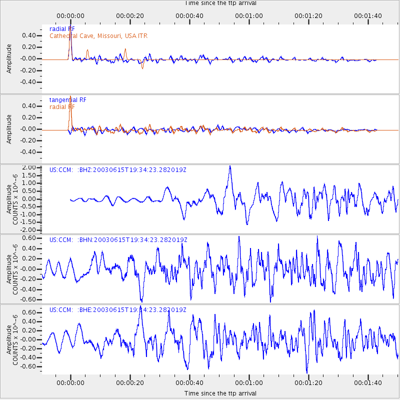
Earthquake location: Rat Islands, Aleutian Islands
Earthquake latitude/longitude: 51.6/176.9
Earthquake time(UTC): 2003/06/15 (166) 19:24:33 GMT
Earthquake Depth: 20 km
Earthquake Magnitude: 6.0 MB, 6.4 MS, 6.5 MW, 6.5 MW
Earthquake Catalog/Contributor: WHDF/NEIC
Network: US United States National Seismic Network
Station: CCM Cathedral Cave, Missouri, USA
Lat/Lon: 38.06 N/91.24 W
Elevation: 222 m
Distance: 62.4 deg
Az: 62.944 deg
Baz: 315.222 deg
Ray Param: 0.06024826
Estimated Moho Depth: 65.75 km
Estimated Crust Vp/Vs: 1.77
Assumed Crust Vp: 6.498 km/s
Estimated Crust Vs: 3.671 km/s
Estimated Crust Poisson's Ratio: 0.27
Radial Match: 85.449104 %
Radial Bump: 361
Transverse Match: 65.14834 %
Transverse Bump: 400
SOD ConfigId: 110177
Insert Time: 2010-03-05 06:51:12.936 +0000
GWidth: 2.5
Max Bumps: 400
Tol: 0.001

Signal To Noise

ChannelStoNSTALTA
US:CCM: :BHN:20030615T19:34:23.282019Z1.25888091.4510844E-71.1526782E-7
US:CCM: :BHE:20030615T19:34:23.282019Z2.85945372.0138319E-77.0427156E-8
US:CCM: :BHZ:20030615T19:34:23.282019Z3.49667624.2622096E-71.2189318E-7
Arrivals
Ps8.2 SECOND
PpPs27 SECOND
PsPs/PpSs35 SECOND