You are here: Home > Network List > US - United States National Seismic Network Stations List
> Station CCM Cathedral Cave, Missouri, USA > Earthquake Result Viewer
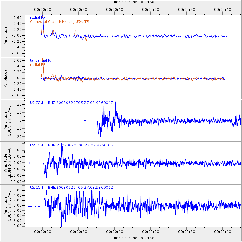
CCM Cathedral Cave, Missouri, USA - Earthquake Result Viewer

| Earthquake location: |
Western Brazil |
| Earthquake latitude/longitude: |
-7.6/-71.7 |
| Earthquake time(UTC): |
2003/06/20 (171) 06:19:38 GMT |
| Earthquake Depth: |
558 km |
| Earthquake Magnitude: |
6.4 MB, 7.1 MW, 7.0 MW |
| Earthquake Catalog/Contributor: |
WHDF/NEIC |
|
| Network: |
US United States National Seismic Network |
| Station: |
CCM Cathedral Cave, Missouri, USA |
| Lat/Lon: |
38.06 N/91.24 W |
| Elevation: |
222 m |
|
| Distance: |
48.9 deg |
| Az: |
339.521 deg |
| Baz: |
153.938 deg |
| Ray Param: |
0.06644692 |
| Estimated Moho Depth: |
49.0 km |
| Estimated Crust Vp/Vs: |
1.68 |
| Assumed Crust Vp: |
6.498 km/s |
| Estimated Crust Vs: |
3.868 km/s |
| Estimated Crust Poisson's Ratio: |
0.23 |
|
| Radial Match: |
95.608086 % |
| Radial Bump: |
400 |
| Transverse Match: |
73.56261 % |
| Transverse Bump: |
400 |
| SOD ConfigId: |
110177 |
| Insert Time: |
2010-03-05 06:51:14.407 +0000 |
| GWidth: |
2.5 |
| Max Bumps: |
400 |
| Tol: |
0.001 |
|
Signal To Noise
| Channel | StoN | STA | LTA |
| US:CCM: :BHN:20030620T06:27:03.936001Z | 48.61269 | 4.587234E-6 | 9.436288E-8 |
| US:CCM: :BHE:20030620T06:27:03.936001Z | 42.12676 | 2.3124012E-6 | 5.48915E-8 |
| US:CCM: :BHZ:20030620T06:27:03.936001Z | 82.321365 | 9.566471E-6 | 1.16208845E-7 |
| Arrivals |
| Ps | 5.4 SECOND |
| PpPs | 19 SECOND |
| PsPs/PpSs | 24 SECOND |


