You are here: Home > Network List > TA - USArray Transportable Network (new EarthScope stations) Stations List
> Station L02F Cave Junction, OR, USA > Earthquake Result Viewer
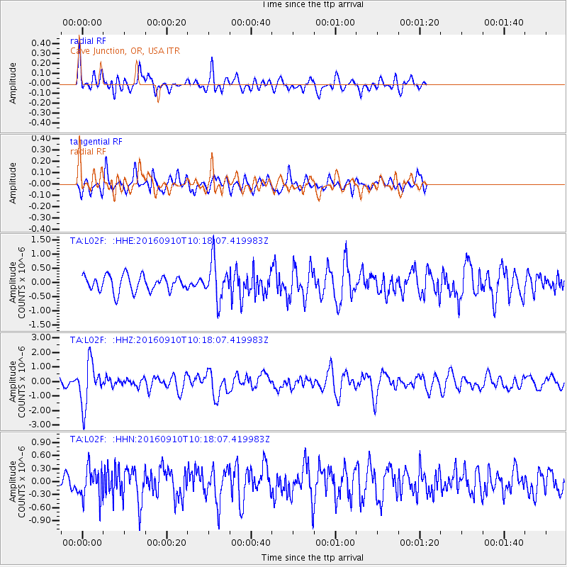
L02F Cave Junction, OR, USA - Earthquake Result Viewer
*The percent match for this event was below the threshold and hence no stack was calculated.
| Earthquake location: |
Northern Peru |
| Earthquake latitude/longitude: |
-5.6/-77.0 |
| Earthquake time(UTC): |
2016/09/10 (254) 10:08:20 GMT |
| Earthquake Depth: |
114 km |
| Earthquake Magnitude: |
6.0 MB |
| Earthquake Catalog/Contributor: |
NEIC PDE/NEIC ALERT |
|
| Network: |
TA USArray Transportable Network (new EarthScope stations) |
| Station: |
L02F Cave Junction, OR, USA |
| Lat/Lon: |
42.12 N/123.57 W |
| Elevation: |
440 m |
|
| Distance: |
63.6 deg |
| Az: |
322.888 deg |
| Baz: |
126.173 deg |
| Ray Param: |
$rayparam |
*The percent match for this event was below the threshold and hence was not used in the summary stack. |
|
| Radial Match: |
67.28557 % |
| Radial Bump: |
400 |
| Transverse Match: |
60.044804 % |
| Transverse Bump: |
400 |
| SOD ConfigId: |
11737051 |
| Insert Time: |
2019-04-25 12:03:56.859 +0000 |
| GWidth: |
2.5 |
| Max Bumps: |
400 |
| Tol: |
0.001 |
|
Signal To Noise
| Channel | StoN | STA | LTA |
| TA:L02F: :HHZ:20160910T10:18:07.419983Z | 6.2493525 | 1.5016471E-6 | 2.4028844E-7 |
| TA:L02F: :HHN:20160910T10:18:07.419983Z | 1.4501724 | 3.557171E-7 | 2.4529297E-7 |
| TA:L02F: :HHE:20160910T10:18:07.419983Z | 2.6145 | 7.167054E-7 | 2.7412713E-7 |
| Arrivals |
| Ps | |
| PpPs | |
| PsPs/PpSs | |


