You are here: Home > Network List > US - United States National Seismic Network Stations List
> Station KNB Kanab, Kane County, Utah, USA > Earthquake Result Viewer
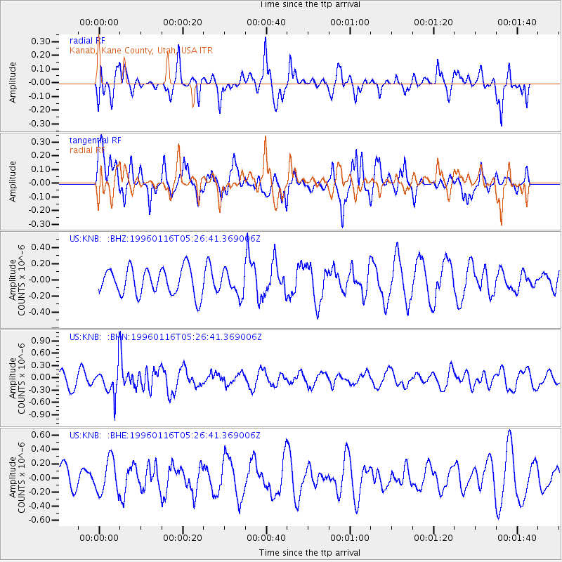
KNB Kanab, Kane County, Utah, USA - Earthquake Result Viewer
*The percent match for this event was below the threshold and hence no stack was calculated.
| Earthquake location: |
Fiji Islands Region |
| Earthquake latitude/longitude: |
-18.7/-177.5 |
| Earthquake time(UTC): |
1996/01/16 (016) 05:15:27 GMT |
| Earthquake Depth: |
334 km |
| Earthquake Magnitude: |
5.7 UNKNOWN, 5.4 MB |
| Earthquake Catalog/Contributor: |
WHDF/NEIC |
|
| Network: |
US United States National Seismic Network |
| Station: |
KNB Kanab, Kane County, Utah, USA |
| Lat/Lon: |
37.02 N/112.82 W |
| Elevation: |
1715 m |
|
| Distance: |
82.3 deg |
| Az: |
46.869 deg |
| Baz: |
239.795 deg |
| Ray Param: |
$rayparam |
*The percent match for this event was below the threshold and hence was not used in the summary stack. |
|
| Radial Match: |
49.077896 % |
| Radial Bump: |
395 |
| Transverse Match: |
69.19373 % |
| Transverse Bump: |
395 |
| SOD ConfigId: |
4480 |
| Insert Time: |
2010-03-05 06:56:55.187 +0000 |
| GWidth: |
2.5 |
| Max Bumps: |
400 |
| Tol: |
0.001 |
|
Signal To Noise
| Channel | StoN | STA | LTA |
| US:KNB: :BHN:19960116T05:26:41.369006Z | 1.7274271 | 3.647538E-7 | 2.1115437E-7 |
| US:KNB: :BHE:19960116T05:26:41.369006Z | 0.6876687 | 2.4495594E-7 | 3.5621213E-7 |
| US:KNB: :BHZ:19960116T05:26:41.369006Z | 0.89207554 | 1.4640071E-7 | 1.6411246E-7 |
| Arrivals |
| Ps | |
| PpPs | |
| PsPs/PpSs | |


