You are here: Home > Network List > TA - USArray Transportable Network (new EarthScope stations) Stations List
> Station L02F Cave Junction, OR, USA > Earthquake Result Viewer
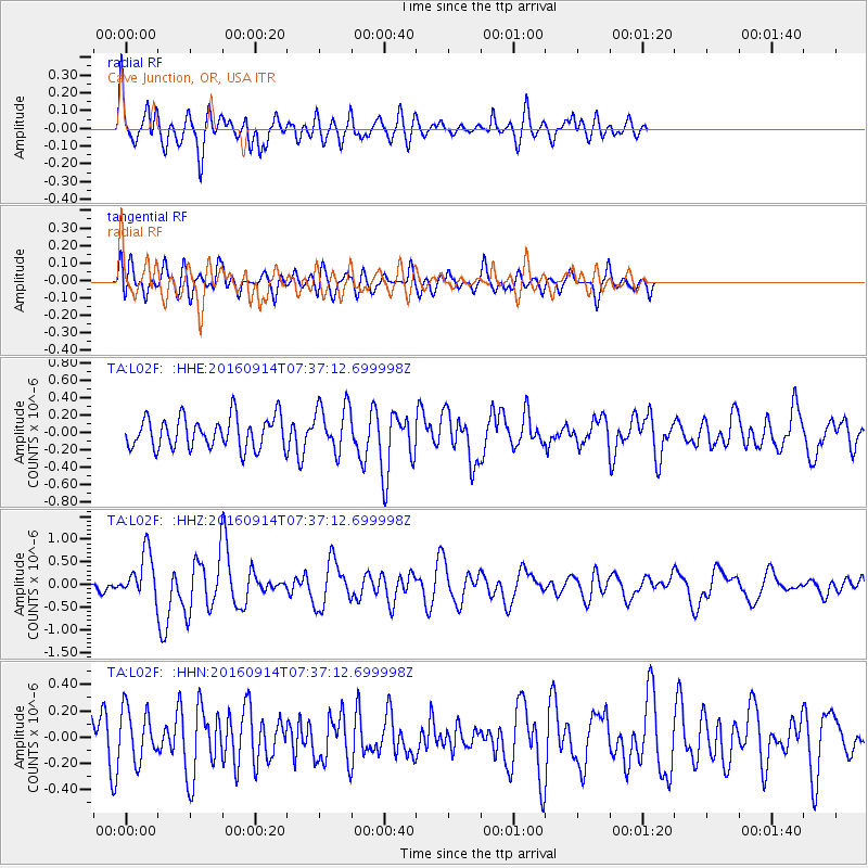
L02F Cave Junction, OR, USA - Earthquake Result Viewer
*The percent match for this event was below the threshold and hence no stack was calculated.
| Earthquake location: |
Solomon Islands |
| Earthquake latitude/longitude: |
-9.4/159.1 |
| Earthquake time(UTC): |
2016/09/14 (258) 07:24:59 GMT |
| Earthquake Depth: |
10 km |
| Earthquake Magnitude: |
6.0 MWB |
| Earthquake Catalog/Contributor: |
NEIC PDE/NEIC COMCAT |
|
| Network: |
TA USArray Transportable Network (new EarthScope stations) |
| Station: |
L02F Cave Junction, OR, USA |
| Lat/Lon: |
42.12 N/123.57 W |
| Elevation: |
440 m |
|
| Distance: |
86.9 deg |
| Az: |
46.616 deg |
| Baz: |
254.583 deg |
| Ray Param: |
$rayparam |
*The percent match for this event was below the threshold and hence was not used in the summary stack. |
|
| Radial Match: |
64.67632 % |
| Radial Bump: |
400 |
| Transverse Match: |
44.92985 % |
| Transverse Bump: |
400 |
| SOD ConfigId: |
11737051 |
| Insert Time: |
2019-04-25 12:52:35.170 +0000 |
| GWidth: |
2.5 |
| Max Bumps: |
400 |
| Tol: |
0.001 |
|
Signal To Noise
| Channel | StoN | STA | LTA |
| TA:L02F: :HHZ:20160914T07:37:12.699998Z | 3.1095004 | 5.136012E-7 | 1.6517161E-7 |
| TA:L02F: :HHN:20160914T07:37:12.699998Z | 0.98759097 | 1.9517675E-7 | 1.9762913E-7 |
| TA:L02F: :HHE:20160914T07:37:12.699998Z | 1.452503 | 2.6620287E-7 | 1.8327182E-7 |
| Arrivals |
| Ps | |
| PpPs | |
| PsPs/PpSs | |


