You are here: Home > Network List > IC - New China Digital Seismograph Network Stations List
> Station HIA Hailar, Neimenggu Autonomous Region, China > Earthquake Result Viewer
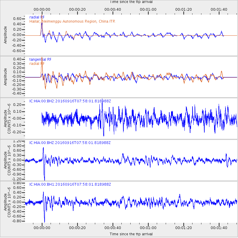
HIA Hailar, Neimenggu Autonomous Region, China - Earthquake Result Viewer
*The percent match for this event was below the threshold and hence no stack was calculated.
| Earthquake location: |
Mindanao, Philippines |
| Earthquake latitude/longitude: |
5.7/125.5 |
| Earthquake time(UTC): |
2016/09/16 (260) 07:50:46 GMT |
| Earthquake Depth: |
193 km |
| Earthquake Magnitude: |
5.4 Mww |
| Earthquake Catalog/Contributor: |
NEIC PDE/us |
|
| Network: |
IC New China Digital Seismograph Network |
| Station: |
HIA Hailar, Neimenggu Autonomous Region, China |
| Lat/Lon: |
49.27 N/119.74 E |
| Elevation: |
620 m |
|
| Distance: |
43.7 deg |
| Az: |
354.542 deg |
| Baz: |
171.69 deg |
| Ray Param: |
$rayparam |
*The percent match for this event was below the threshold and hence was not used in the summary stack. |
|
| Radial Match: |
76.45961 % |
| Radial Bump: |
400 |
| Transverse Match: |
71.12935 % |
| Transverse Bump: |
400 |
| SOD ConfigId: |
11737051 |
| Insert Time: |
2019-04-25 13:09:56.311 +0000 |
| GWidth: |
2.5 |
| Max Bumps: |
400 |
| Tol: |
0.001 |
|
Signal To Noise
| Channel | StoN | STA | LTA |
| IC:HIA:00:BHZ:20160916T07:58:01.818988Z | 5.7936 | 3.9778323E-7 | 6.865908E-8 |
| IC:HIA:00:BH1:20160916T07:58:01.818988Z | 4.8020205 | 2.463715E-7 | 5.1305808E-8 |
| IC:HIA:00:BH2:20160916T07:58:01.818988Z | 2.0031846 | 9.552804E-8 | 4.7688086E-8 |
| Arrivals |
| Ps | |
| PpPs | |
| PsPs/PpSs | |


